
SPOKANE, Wash. — Following Monday’s windstorm, temperatures dropped across the Inland Northwest and this will likely lead to the first measurable snowfall of the season in Spokane.
Spokane and surrounding areas already saw graupel showers on Tuesday. Graupel resembles soft hail or ice pellets like sleet but it is formed differently. The Washington State Department of Transportation also tweeted a photo on Tuesday of a snow squall working its way through north Spokane, with some buildup on grassy surfaces and mostly wet roads. Spokane's South Hill also saw snow showers on Tuesday afternoon.
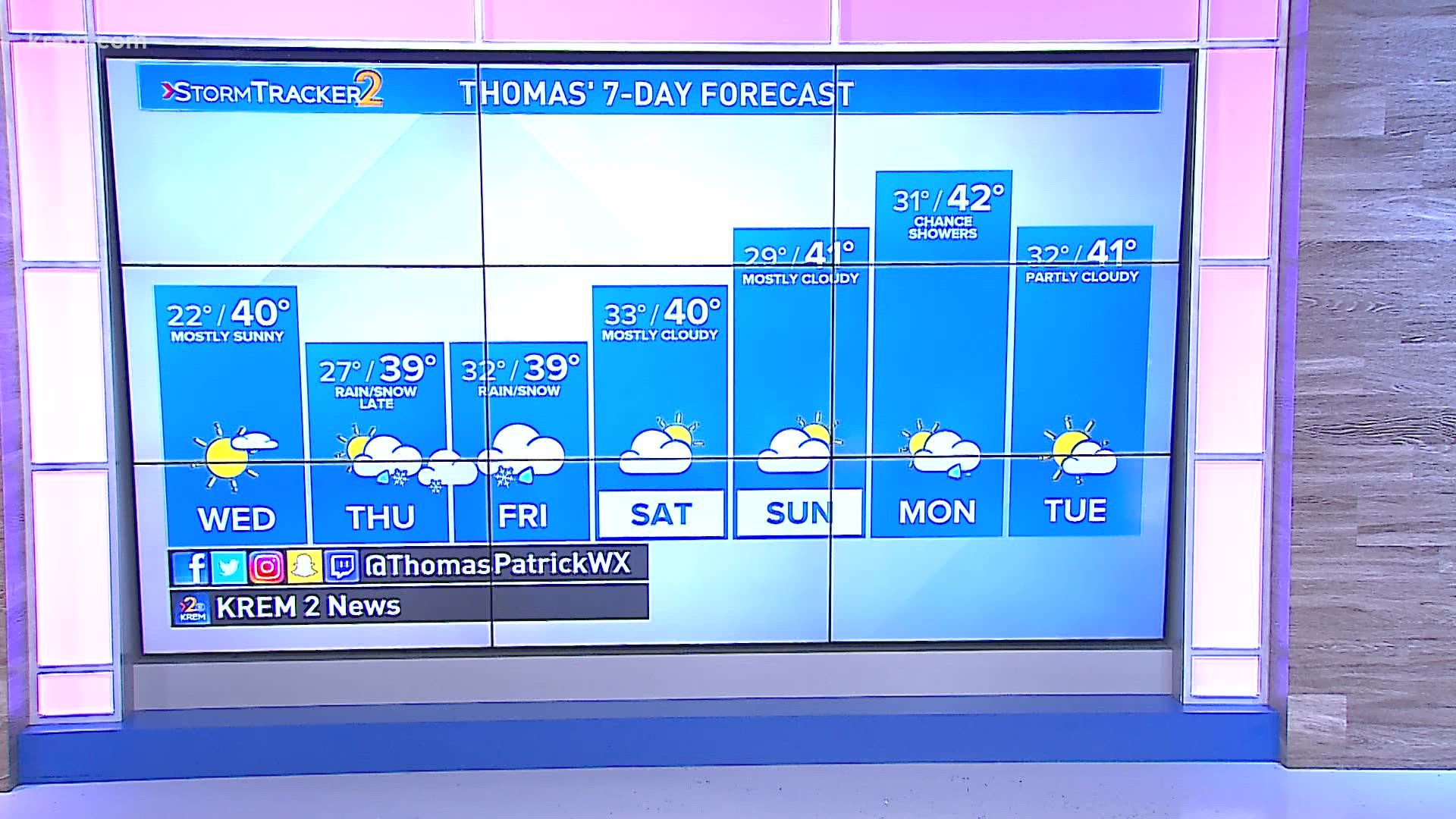
Spokane will likely get a measurable snowfall Thursday night and Friday. But it will be slushy and wet, topping out at about one inch. More solid snow is expected in northern Washington and some areas of North Idaho.
The two biggest factors at play regarding the snowstorm are still up in the air. The first is timing. The storm must hit at the exact right time. If it arrives Thursday afternoon, it will be too warm and everything will fall as rain. If it's too late, it will be rain again on Friday. If it hits overnight Thursday into Friday, it might be cold enough that it’s snow for areas that have yet to see the first this season.
The second major factor is the storm track. More specifically, how far north or south the storm moves through the Northwest. While there is decent model agreement on the amount of moisture and the arrival of the storm, the difference in track is the variable that gives the Inland Northwest and Spokane the highest uncertainty. Two prominent forecast models put the snow in Spokane and even some other lower elevation areas that have missed out recently. However, other models give all that moisture to Oregon.
As of Wednesday evening's forecast, the timing will mainly be between midnight and noon on Friday, which would be at the coldest point of the day. Scattered rain or snow showers are possible Thursday evening as well as Friday afternoon. The storm track generally moves through Oregon. While the bulk of the moisture will be to the south, this is a cold storm track which should lead to some sort of snow north of Highway-2.
Spokane sits about one week beyond its average first measurable snow of the season. Historically, the average date is Nov. 10. In order to count, there must be at least 0.1 inches of snow measurable at the official snow stake.
This late snow isn’t anything out of the ordinary, as the first snows happen in December from time to time. La Niña winters, or more specifically big snow La Niña winters, have been notoriously late to get the snowball rolling.
Send us your weather photos by using the "Near Me" feature on the KREM 2 mobile app. You will see them on our website and app, and they may appear on TV!