SPOKANE, Wash. — More wild weather is moving into the Inland Northwest ahead of the weekend.
Meteorologist Michelle Boss says wind gusts could reach 40-50 mph in the area on Friday. Sustained winds will likely sit between 20-30 mph.
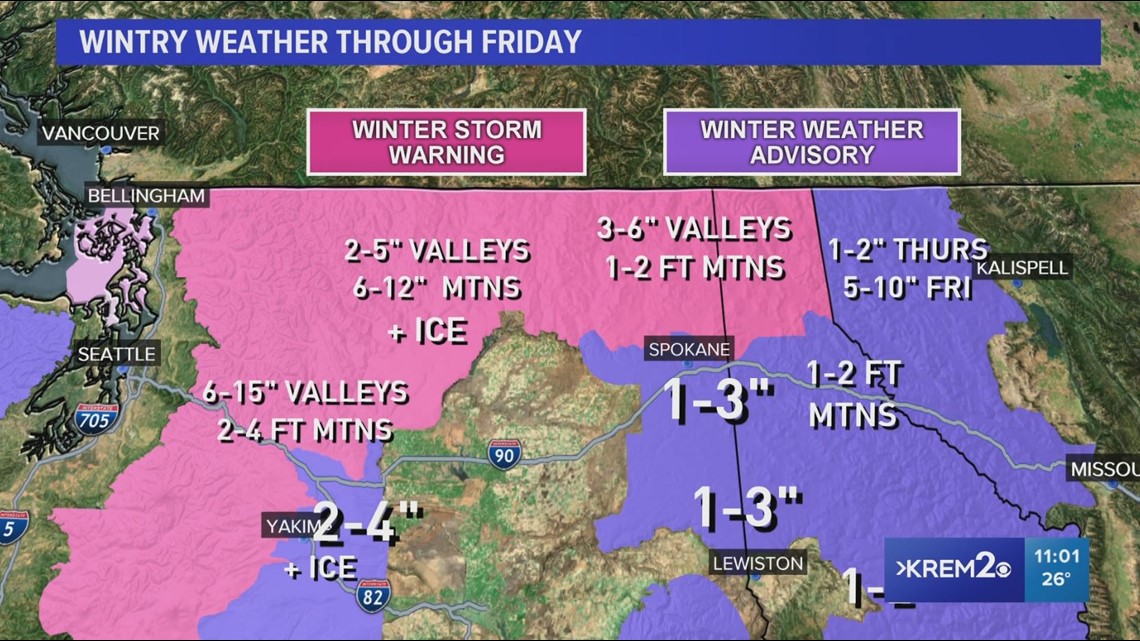
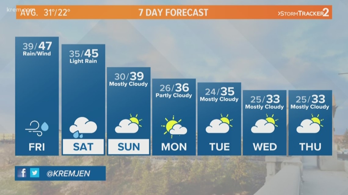
Northern valleys and the mountains will see more snow on Friday. In Spokane area, unseasonably high temperatures in the mid to upper 40s are expected for the weekend.
The average high for this time of year is 32 degrees.
Warmer temperatures come after snow blanketed areas around the Inland Northwest on Thursday morning. Some school districts in central Washington and North Idaho are opening late or closing on Friday due to icy roads and hazardous weather.
The National Weather Service said snow began falling at about 3 a.m. in the Spokane area.
A total of 2.5 inches of snow was recorded at the Spokane Airport. KREM Meteorologist Michelle Boss recorded 2 inches of snow at 7:30 a.m. in Greenacres.
Three-and-a-half inches of snow fell on Spokane's South Hill and three inches fell in Spokane Valley, meteorologists said.
Snow transitioned to rain by Thursday evening in Spokane and Coeur d'Alene.
Winter Storm Warnings are in effect for the Cascades, North-central and Northeastern Washington, and the Northern Pandhandle of Idaho for heavier accumulations as snow continues to fall through Friday morning.


Timing of the light snow and below freezing temperatures on Thursday morning made for slick conditions on the roads. Hazardous conditions were reported on stretches of Interstate 90 in the Spokane area and on several Inland Northwest highways.
Several school districts in central Washington opened two hours late on Thursday morning due to icy roads. Spokane Public Schools said they would open and on time, despite the early morning snowfall and icy roads.
Rain is expected to continue through the weekend, melting the snow.
Friday and Saturday could see highs in the mid-40s.
As warm air surges into the region, Meteorologist Michelle Boss says we are also expecting some pretty strong winds on Friday. Gusts in excess of 40-50 mph will be possible, especially on Friday morning.
Drivers with travel plans over the mountain passes will want to check conditions this week, as heavy mountain snow is also in the forecast. The most significant impacts are expected beginning Thursday through Sunday.
The National Weather Service expects that 3-5 feet of snow will fall at Stevens Pass in 72 hours, with 12-18 inches expected on Snoqualmie Pass during the same time period.
Normally, Spokane sees about 16 inches of snow through Dec. 19, according to KREM meteorologist Thomas Patrick. So far, Spokane has seen just under 11 inches of snow.
Last year, Spokane only saw 8.5 inches of snow through mid-December.
Last Sunday, snow fell across parts of the Inland Northwest and made local driving conditions slick as light accumulations blanketed the roads.
Thomas Patrick says about an inch of snow fell in the Spokane area on Sunday, Dec. 15.

