SPOKANE, Wash. — Snow showers are making their way into the Spokane area on Monday ahead of more winter weather for New Year's Eve.
The National Weather Service says snow flurries and showers may be seen through Monday afternoon. Accumulations should be limited, with trace amounts to a thin coating.
Winter weather could also complicate drivers' holiday travel plans and celebrations heading into the new year.
One final winter storm of the year may drop as much as six inches of snow in some northern valleys and up to 14 inches on mountain tops. Rain and wind will also be added into the mix.
The timing of this storm system starts as snow during the morning hours Tuesday. Some North Idaho location may even see a light snow showers as early as 10 p.m. on Monday, but the bulk of the snow will fall in earnest between 4 a.m. to 10 a.m. on Tuesday morning.
But as temperatures warm throughout the day on Tuesday, the snow will eventually change to rain.
That will complicate exactly how much snow will fall, as the snow may start melting away as quickly as it fell in the first place.


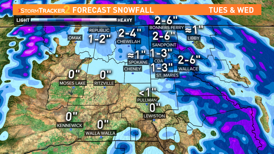
KREM Meteorologist Thomas Patrick is predicting about 1 inch of wet snow in the Spokane area, about one to three inches of Coeur d'Alene, and two to six inches around Sandpoint and Bonners Ferry.
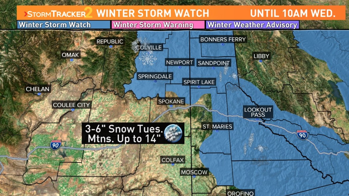
Areas under a Winter Storm Watch include Sandpoint, Bonners Ferry, Kellogg, Fourth of July and Lookout Passes, Colville and Deer Park. Remember that "watches" will get reassessed into "warnings" and "advisories" on Monday afternoon or early Tuesday morning.


The National Weather Service says travel could very difficult in these areas, as hazardous conditions could impact the Tuesday evening and Wednesday morning commutes.
Drivers heading over the mountain passes should check conditions before they hit the road, as heavy snow is in the forecast on Tuesday night and again on Friday and Saturday.
December's snowfall total so far in Spokane sits at 6.8 inches, which is not even half of a normal December snowfall.
Spokane typically averages about 14.6 inches of snow each December. This comes off the back of a dry November for the area, where it only snowed six-tenths of an inch on a single day.
The biggest snow of the month so far came on Dec. 19, with 2.7 inches in a single day.
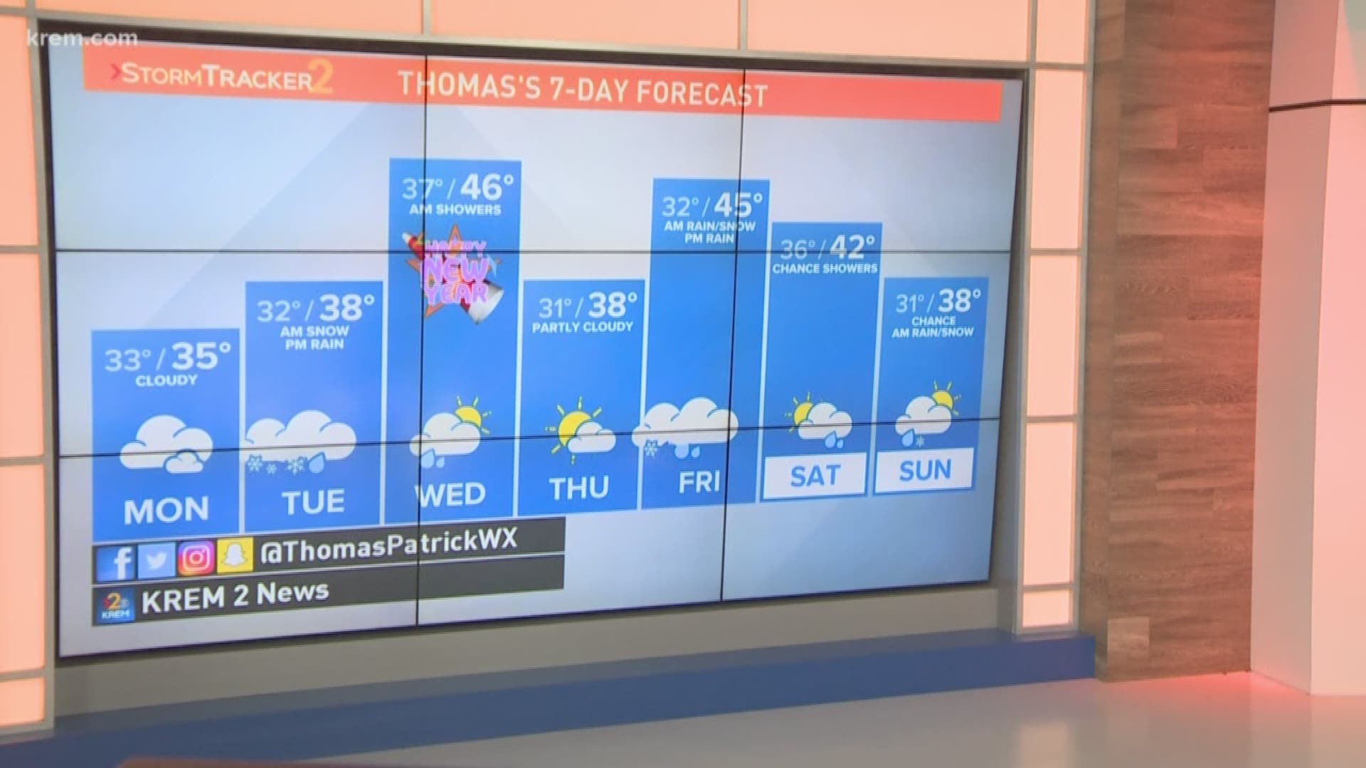
The new year in Spokane will begin with above normal high temperatures in the upper 30s and low 40s.

