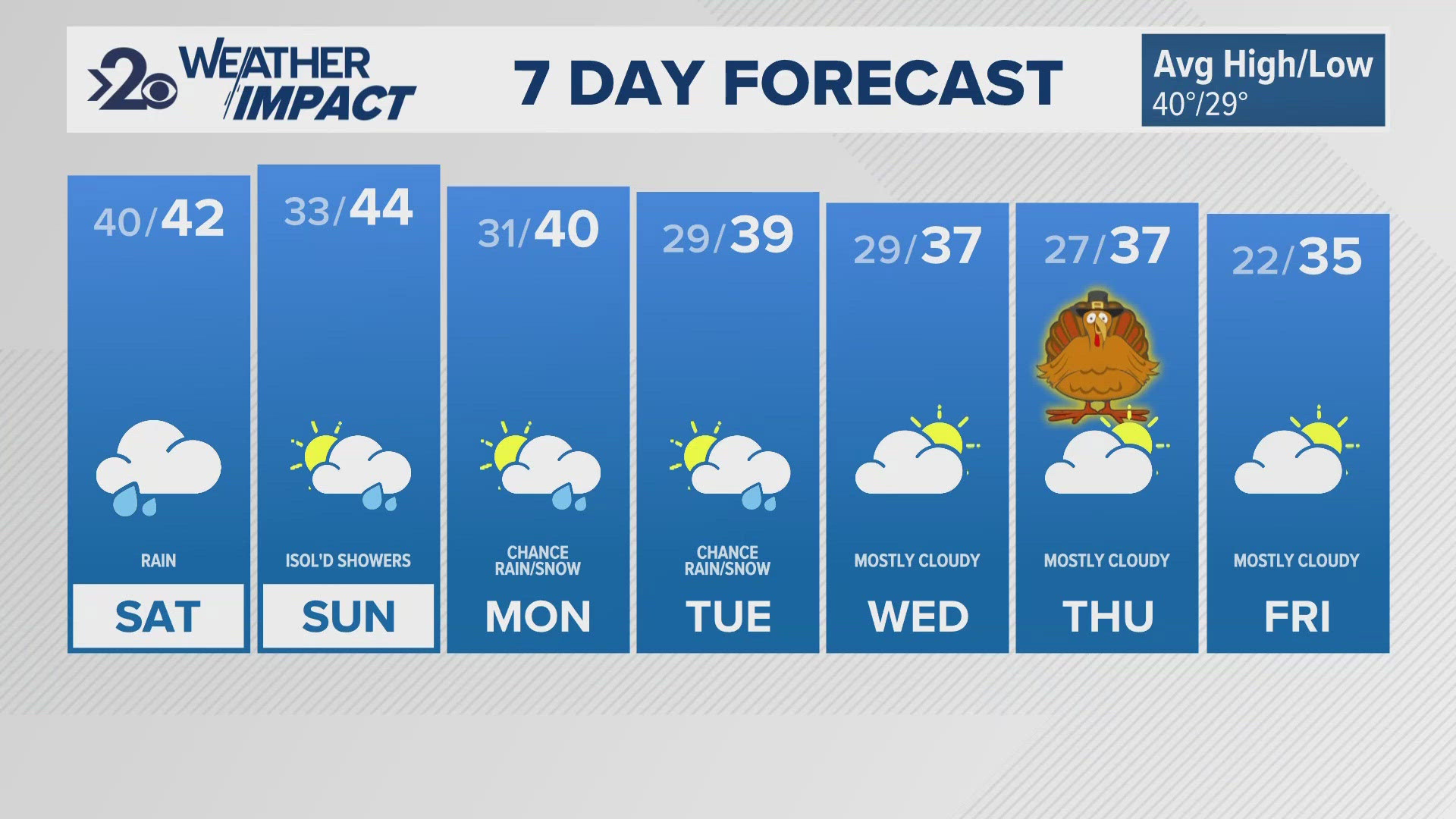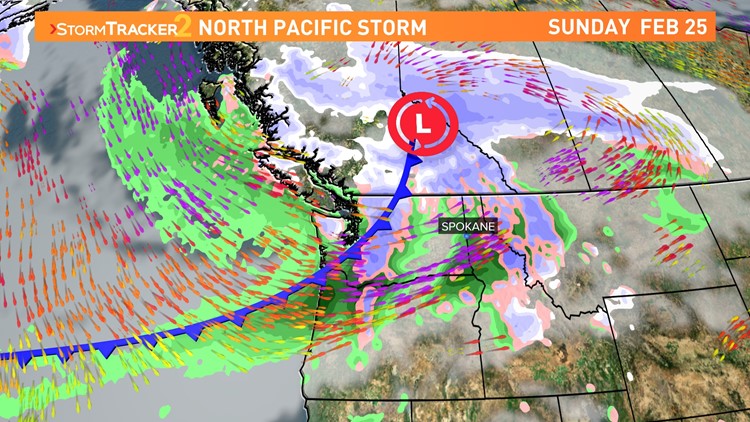
SPOKANE, Wash. — Major weather changes are happening Sunday into early next week with a potent storm out of the North Pacific set to slam through the Northwest.
At a glance, the storm will arrive Sunday with rain and wind at first before significantly dropping temperatures into Monday when lowland snow will be more likely. At the moment, the high winds are standing out as the more important factor of this storm.
Wind gusts on Sunday will start at 20-30mph and increase through the day, peaking at 50+ mph around 6pm to midnight on Sunday evening. That will likely prompt Wind Advisories for the region. At those speeds, tree damage and power outages are possible. Winds gusts will remain around 30-35mph on Monday.
For precipitation, some rain will be seen on Sunday with the best chance after 4pm. The mountains will see heavy snow above 3,500'. The mountain ranges in North Idaho as well as the Cascades are under Winter Storm Watches and predicting upwards of 12-30" of snow for the mountain peaks. This will affect those driving over the mountain passes from Saturday night through Tuesday morning.
On Monday, temperatures fall quickly due to the cold front that leads the push of more arctic air. Temps will approach 32° Monday morning, but may stay on the plus side of freezing for Spokane, just barely. This means that precipitation will be a wet- wintry mix as the prospects of accumulating snow aren't seen immediately.
However, the colder air mass will settle in during the 12-24 hours following the cold front passage which will keep temperatures dropping into the low 30s and eventually low 20s by Tuesday morning. Any moisture that arrives during this cold snap will result in lowland snowfall.
WATCH RELATED: Weekend weather for February 23-24 in the Inland Northwest