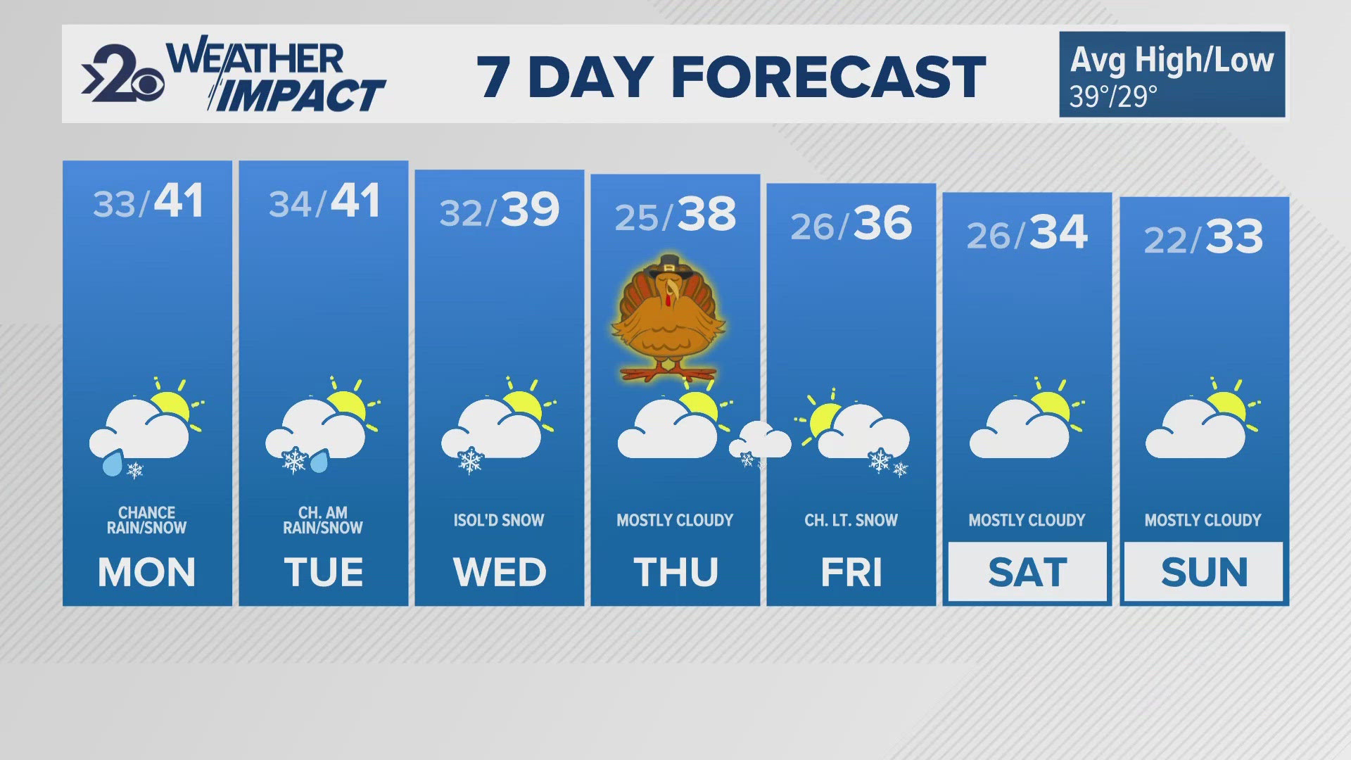
SPOKANE, Wash. — It's that time. Spokane is expecting our first snow of the season on Wednesday morning.
The forecast as of Monday morning, 48 hours in advance, highlights a storm system that develops out of the cold North Pacific and quickly develops to hit the Pacific Northwest this week. Because of the polar-maritime origins, this will be a cold and wet storm which will be cold enough for snow, even at lower elevations.
As a reminder, all the details aren't completely set in stone as latest observation data, computer models, and analysis is an ever-evolving process. But here's what we do know and the key messages ahead of this first winter storm.
Timing: Snow begins Wednesday morning between midnight and 8 a.m. The bulk of the snow will fall between then and early afternoon. It'll tail off into scattered rain and snow showers Wednesday evening, Thursday and Friday, so there's no clear "end" time for the snowfall.
Snow Totals: 1-2" is the most likely case for locations along and north of US-2. This includes Spokane, Davenport and all of Northern Washington. Most of North Idaho will see the same, including Coeur d'Alene. Locations closer to Ritzville, Moses Lake and eastern Whitman County will see a rain/snow mix and probably won't see snow accumulations. The Palouse, for Pullman and Moscow, is leaning towards less snow, closer to 1," but the forecast is still very flexible. Some across far northern Washington and Idaho could push 3 or 4 inches of snow in the greatest cases.
Black Ice: Leftover snow, water, or even rain Wednesday will likely freeze into Thursday morning with low temperatures in the mid-20s. This can lead to black ice a day after the main snowfall
Mountain Snow: Mountain Passes including Snoqualmie and Sherman will see significant snowfall starting Tuesday night and through the day Wednesday. The Northern Cascades will get the most snow with some mountain peaks topping 12".
To recap, morning commuters on Wednesday will contended with a slushy and wet first snow of the year. And then again Thursday morning, black ice very well could make roads very slippery.
DOWNLOAD THE KREM SMARTPHONE APP
DOWNLOAD FOR IPHONE HERE | DOWNLOAD FOR ANDROID HERE
HOW TO ADD THE KREM+ APP TO YOUR STREAMING DEVICE
ROKU: add the channel from the ROKU store or by searching for KREM in the Channel Store.
Fire TV: search for "KREM" to find the free app to add to your account. Another option for Fire TV is to have the app delivered directly to your Fire TV through Amazon.
To report a typo or grammatical error, please email webspokane@krem.com.


