SPOKANE, Wash. — One more winter storm to get through. One last blast from old man winter. This is the final hump before we truly turn the corner and welcome spring into the Inland Northwest.
Moderate to heavy snow is expected, with the highest accumulations over the northeast portion of Washington and the northern Idaho panhandle. Three to four inches of snow are expected in Spokane and Coeur d’Alene on Tuesday with slightly heavier amounts farther north, according to KREM Morning News weather anchor Evan Noorani.
The heaviest snow affected the morning commute on Tuesday, with slide-offs and crashes reported throughout the Inland Northwest.
Nearly 25 schools were closed or delayed in around the Inland Northwest on Tuesday morning.
Snow showers are beginning to taper off in Spokane. They will most likely transition to rain or freezing rain later in the day.
There is a high confidence that Tuesday's snow will be the last of the winter, according to KREM meteorologist Thomas Patrick.
The good news: spring will be here soon.
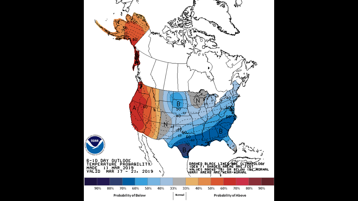
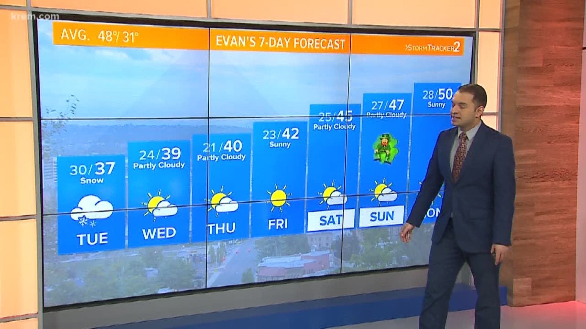
After this winter storm, temperatures will easily rise into the 40s by Thursday of this week. St. Patrick's Day weekend may be knocking on the door of 50 degrees but if not by the holiday, we will see 50s shortly after. The Climate Prediction Center's 6-10 day outlook (March 17-21) is easily above average.


The Spring Equinox happens at 2:58 p.m. on Wednesday, March 20. The average high temperature on that date is 50 degrees and we trend above average for the remainder of the month. On the very off-chance a cold weather system infiltrates the Inland Northwest, we will still be hard pressed to get 20 degrees below average and snowfall for Spokane.


