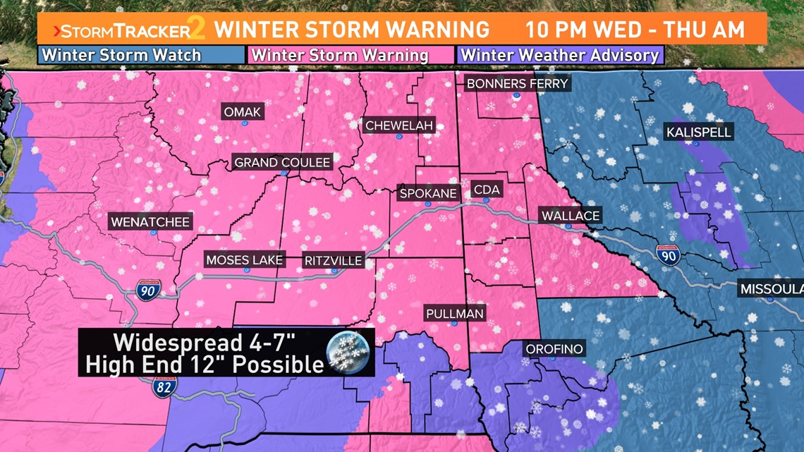
SPOKANE, Wash. — Winter storm warnings are in place across the Northwest ahead of an incoming storm. Widespread snow is expected from the Cascades to the Northern Rockies Wednesday night into Thursday.
The incoming storm brings the potential of more mountain pass closures and upwards of half a foot of snow in low elevation areas of Eastern Washington.
Significant snow events require three main ingredients:
- Cold, so it’s not rain
- Moisture to create the snow
- Energy or a storm to bring the moisture from the atmosphere to the ground
The incoming system has all three ingredients.
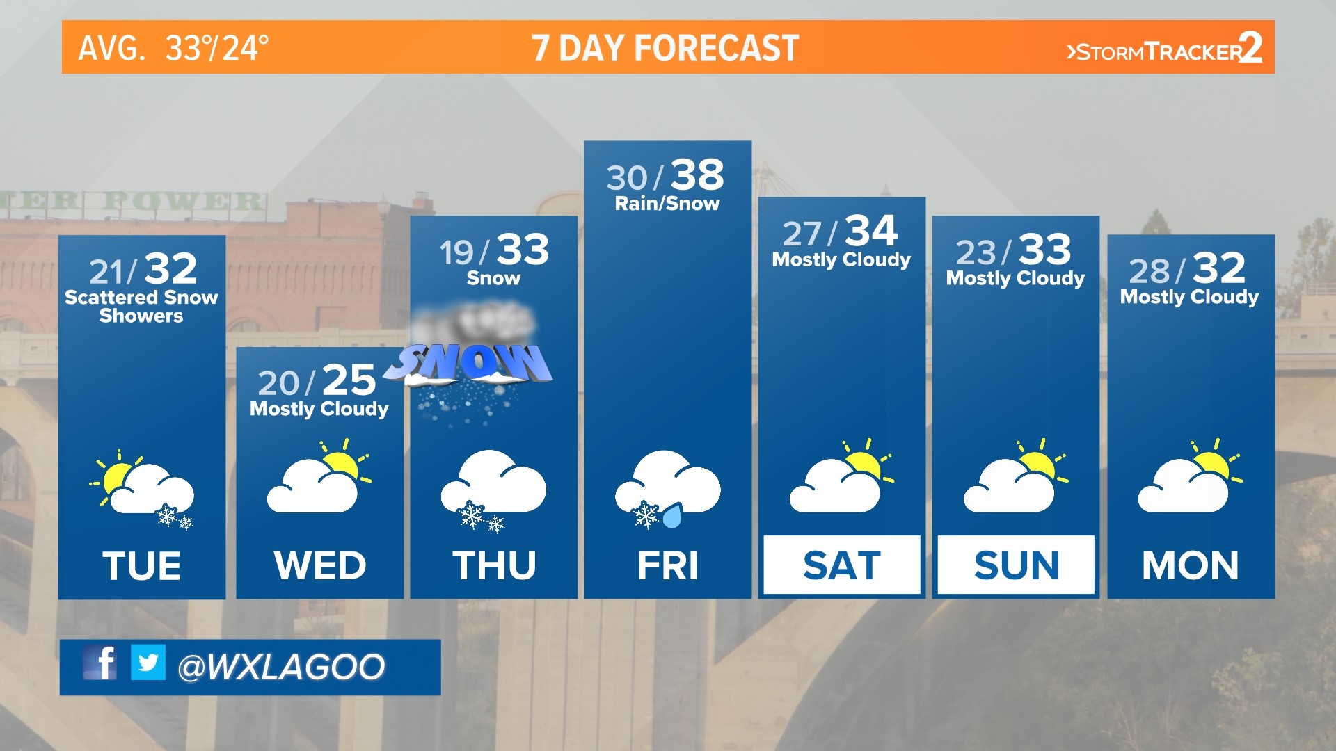
Following Wednesday morning’s snow, temperatures will hover below freezing. Highs Wednesday will be in the mid-20s, setting the stage for the incoming storm to bring snow. The snow arrives along an incoming warm front. This is the perfect way to bring significant moisture, and in this case snow, to the Inland Northwest.
Right now, models are in pretty solid agreement on timing. The snow looks to start late Wednesday night in Spokane, after 10 p.m., and continue through the Thursday morning commute.


Spokane will pick up anywhere between 4 & 7 inches of snow. Coeur d’Alene will likely see 5 to 9 inches of snow by the time it comes to an end, making this potentially the biggest storm those cities have seen all winter. Higher elevations in the Cascades and Northern Rockies will pick up an easy 8 to 14 inches of fresh snow by the time it ends Thursday.
Areas of concern are the Columbia Basin and the Lewis and Clark Valley. In these regions, the incoming moisture could be enough to bump temperatures up above freezing. That would be enough to cause a wintry mix or even a little rain to fall on top of the 2-3 inches of snow that accumulates overnight.
The low pressure center itself will close in on the Northwest on Friday. That will keep the precipitation in the forecast through the end of the week. At this time, Spokane will find itself in the warm sector of the snow and daytime highs will climb to near 40 degrees. That means it’s likely the storm ends with rain, but the westerly flow of the storm means there won’t be as much moisture as what hits early Thursday.
The biggest impacts will take place on Thursday. Both the morning and evening commutes will see major impacts from this potent winter storm. Stay with KREM 2 for the latest on road conditions and school closures as the storm arrives.

