SPOKANE, Wash. — It's that time of year when we start looking ahead towards the winter weather season.
Or is it?
Actually, it's way too soon to start thinking about winter. It's still summer! We're forecasting heat waves and high fire danger in Washington and it's the middle of hurricane season out east.
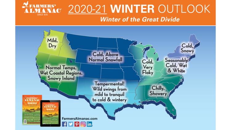
But that doesn't stop the Farmers' Almanac from releasing their yearly winter weather prediction for the U.S. If you're curious, I'll save you a Google search. Here's what the Farmers' Almanac has in store for the winter of 2020-2021.
"Mild [and] dry," sounds great for Spokane and the Pacific Northwest!


Sorry to be the bearer of bad news, but as a meteorologist I have to say, "not so fast." This obviously isn't the be-all-end-all of forecasts and predictions. So even though it is still way too early to be looking at winter, I'll humor you if you've made it this far.
The winter months of December, January, and February average 32.8" of snow each season in Spokane, and 44.9" of snow if you include the whole year (fall and spring too). And temperature-wise, the average is about 30 degrees (that's between the highs and lows for the entire season.)
So a mild and dry forecast suggests that will be warmer than average and probably less snowy than average.
But, from a meteorological perspective, Spokane might very well see the complete opposite.
When it comes to winter forecast, the most influential factor in our overall weather pattern is El Nino. How warm or cold the Pacific Ocean waters are influence how the jet streams are orientated during the winter.
This winter, the El Nino phase will likely be negative, which is called "La Nina." This means that the Pacific Ocean waters are colder than average due to more up-welling along the South American west coast. Here's how that adjusts the overall weather pattern in the U.S.

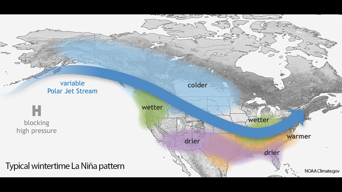
You see that the Pacific Northwest is overlaid with both colder and wetter than average.
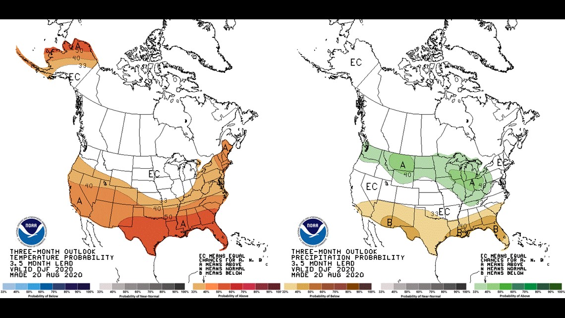
The Climate Prediction Center, which tracks long-term forecasts for the nation range from 6 days to 3 months and beyond, has issued a La Nina Watch, with a 60% chance of seeing La Nina conditions in the Pacific Ocean by the time winter arrives.
Additionally, the CPC's extended 3-month outlooks correlates this upcoming winter with a typical La Nina winter. Above normal precipitation (and likely snowfall) is likely across the northern tier of the U.S., especially in Montana and the Great Lakes region. And while not "colder than average," the southern U.S. is forecast to be warmer than average, which again is consistent with La Nina. Here's their current forecast below.

So why does everyone get excited about the Farmers' Almanac winter outlook? Probably just because it's the first outlook of the year.
But "first" doesn't mean "best." In fact, when it comes to meteorology, we should all know that the forecast is most accurate when the thing we're forecasting is in the near future, not the far future. That holds true whether is a 7-day forecast or a 7-month forecast.
The National Weather Service typically releases their, in my opinion, far more accurate, winter weather outlook around mid-October, two months from now. And KREM Chief Meteorologist Tom Sherry will deliver our local winter weather outlook in November!
In the meantime, try to resist the hype. It's a long time before it's winter, so there's plenty of time to enjoy the rest of summer before you worry about the snow.