
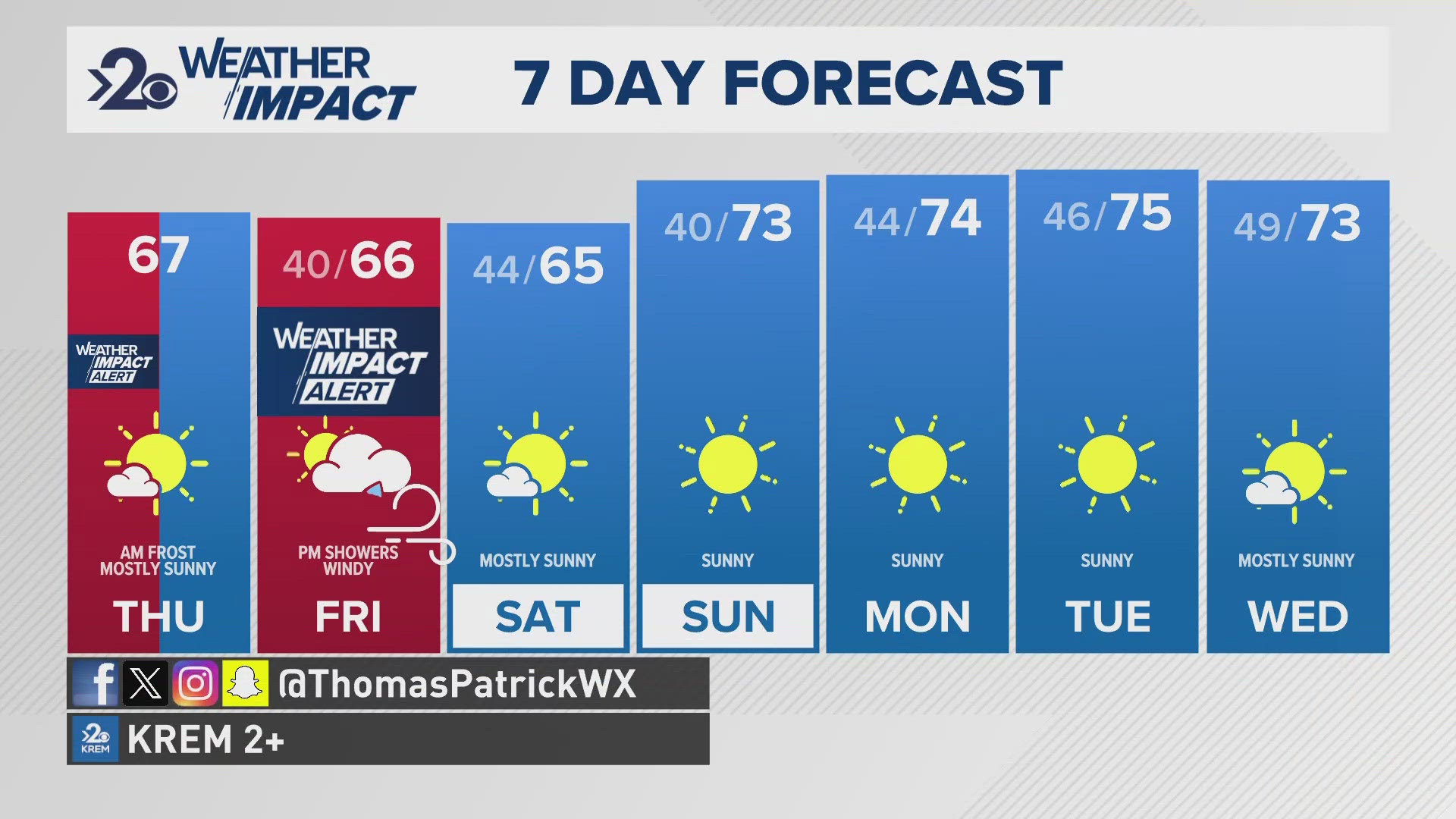
SPOKANE, Wash. — Another batch of high winds and blowing dust is likely to affect the Inland Northwest region during a dry Friday. KREM 2 meteorologists have placed Friday as a Weather Impact Alert Day due to the threat for high winds and dust storms in the Inland Northwest.
NWS Spokane has issued a number of alerts as well. A Blowing Dust Advisory is issued for the Spokane area and all of central Washington from 2 p.m. to 7 p.m. on Friday as wind gusts will rise up to 40mph with the threat of dust storms. This is supplemented by a Wind Advisory for the Pullman and Lewiston areas for the same time frame. Wind gusts in this region will be up to 50mph.
It's important to know that blowing dust and dust storms aren't just likely, but most probable on the Palouse tomorrow because that's the region that'll experience the strongest wind speeds. So no matter which type of advisory you find your self under, realize that there will be a risk for dust storms and low visibility for our local highways and interstates. Should you encounter low visibility, be sure to turn your headlights to the on position and drive more slowly - what's appropriate for the current weather conditions.
Furthermore, Red Flag Warnings and Fire Weather Watches have been issued for eastern Washington and north-central Idaho from 12 p.m. to 6 p.m. on Friday to supplement the wind threat with a high fire risk because of, again, the windy conditions during the day.
When: 2-7 p.m. Friday.
Impact: High winds up to 50 mph and potential for dust storms.
Need to Know: Secure loose objects in the yard beforehand and drive more cautiously during low visibility conditions on highways.