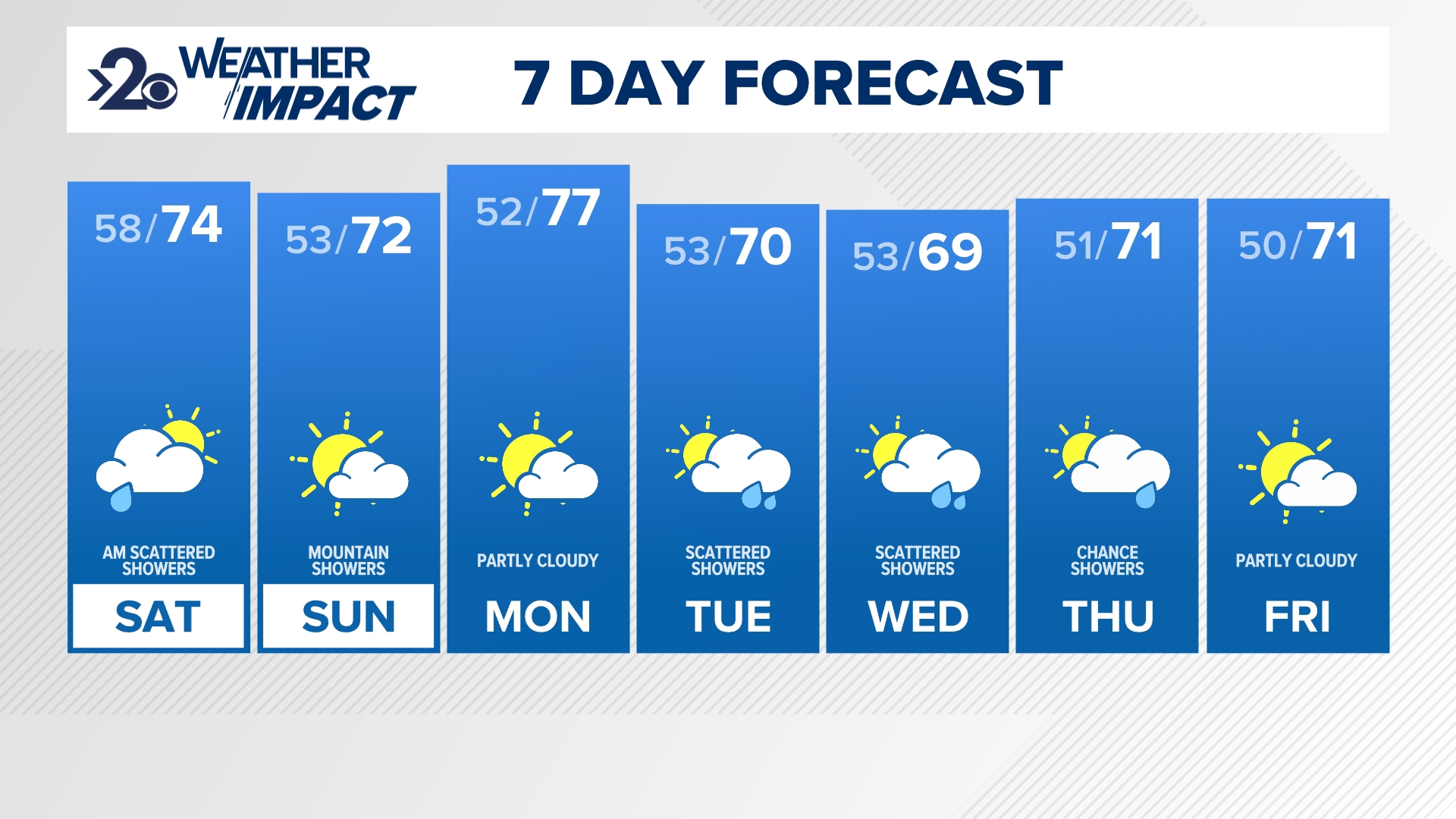
SPOKANE, Wash. — A quick burst of wind will impact the area on Tuesday as a result of a passing cold front. While the winds will be fairly strong themselves, it's the dry 'and windy combination that also increases fire danger for eastern Washington. Because of that, the KREM 2 weather team has gone with a Weather Impact Alert Day for Tuesday due to the strong winds and increased fire danger.
NWS Spokane has issued Red Flag Warnings for eastern Washington from 2 pm to 8 pm on Tuesday as wind gusts increase to 45mph and humidity levels drop to less than 20% during the afternoon. That means fire danger is heightened today, so be sure to avoid burning or doing campfires or bonfires.
Additionally, NWS Pendleton has issued Wind Advisories for the Tri-Cities and Ellensburg areas for wind gusts that will peak at 45mph. Effectively, both types of alerts cover the same threat: the wind.
When: 2-8 pm Tuesday
Impact: Strong winds & heightened fire danger
Need to Know: Secure loose objects outside so they won't blow away. And avoid outdoor activities involving fire, like campfire for tonight as tonight all due to the stronger winds.