SPOKANE, Wash. — March was a dry month for Washington state. From coastal shores of the Pacific to the foothills of the Northern Rockies, many locations closed out the month with a significant lack of precipitation.
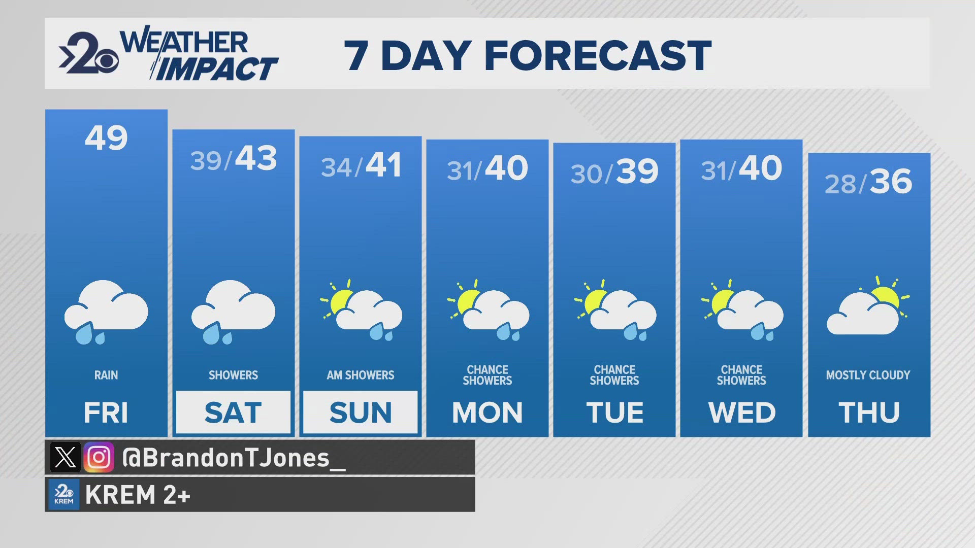
The abnormally dry conditions are playing a role in the weather across the Inland Northwest. Everything from the temperatures to the dust storm this past weekend to the day-to-day temperatures correlates to recent moisture or lack thereof.
The dry ground of central Washington contributed to Sunday’s dust storm. All of the loose top soil was picked up by the strong winds and stirred into the atmosphere. Some of that dust and dirt traveled pretty far as the storm moved east.

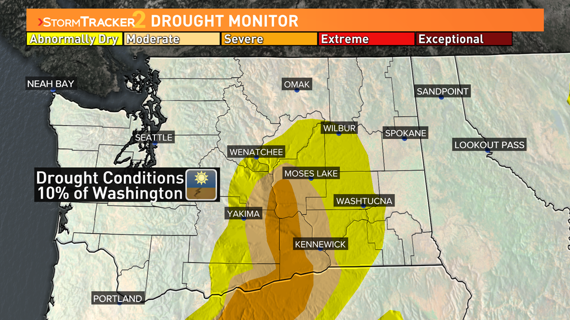
March contributed to ongoing drought conditions for parts of Washington. Parts of central and south central Washington are under severe drought conditions, totaling just under 4% of the state. Add in moderate drought conditions and that number jumps to almost 10% of the state, with much of central Washington reporting abnormally dry conditions.

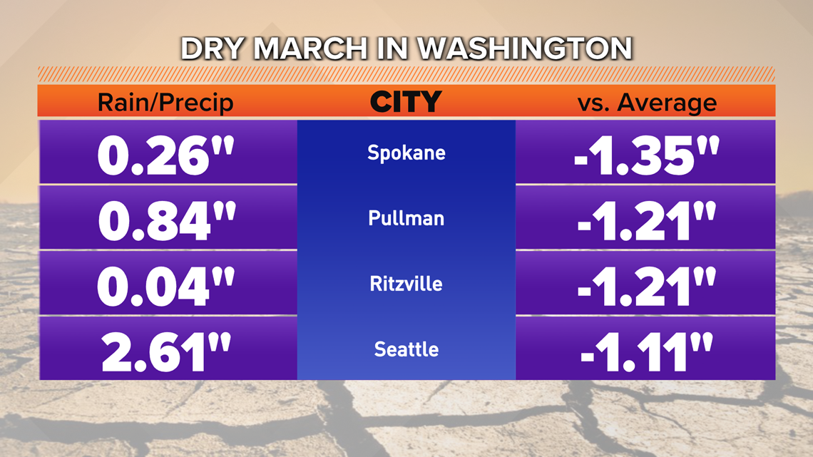
When it comes to total precipitation many of Washington state’s biggest cities are more than an inch shy of what is normal for the month in terms of rain or the melted snow equivalent. In Spokane, that is more than ¾ of our March moisture. Even Seattle came up an inch short. Not as big of a percentage, but a noticeable drop.

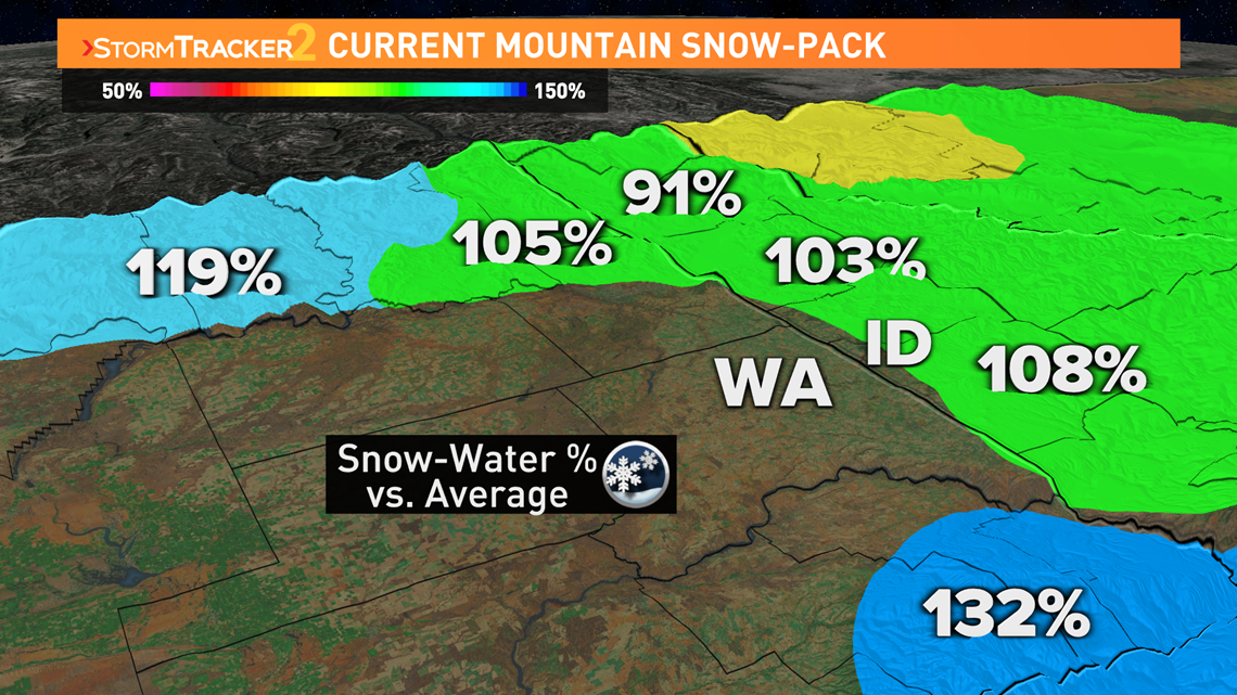
There is a little good news hiding in the data. Higher elevations are sitting close to normal in terms of snow-water equivalent. The reason that is good news is the mountain snow-melt plays a big role in water presence as it melts in the summer.

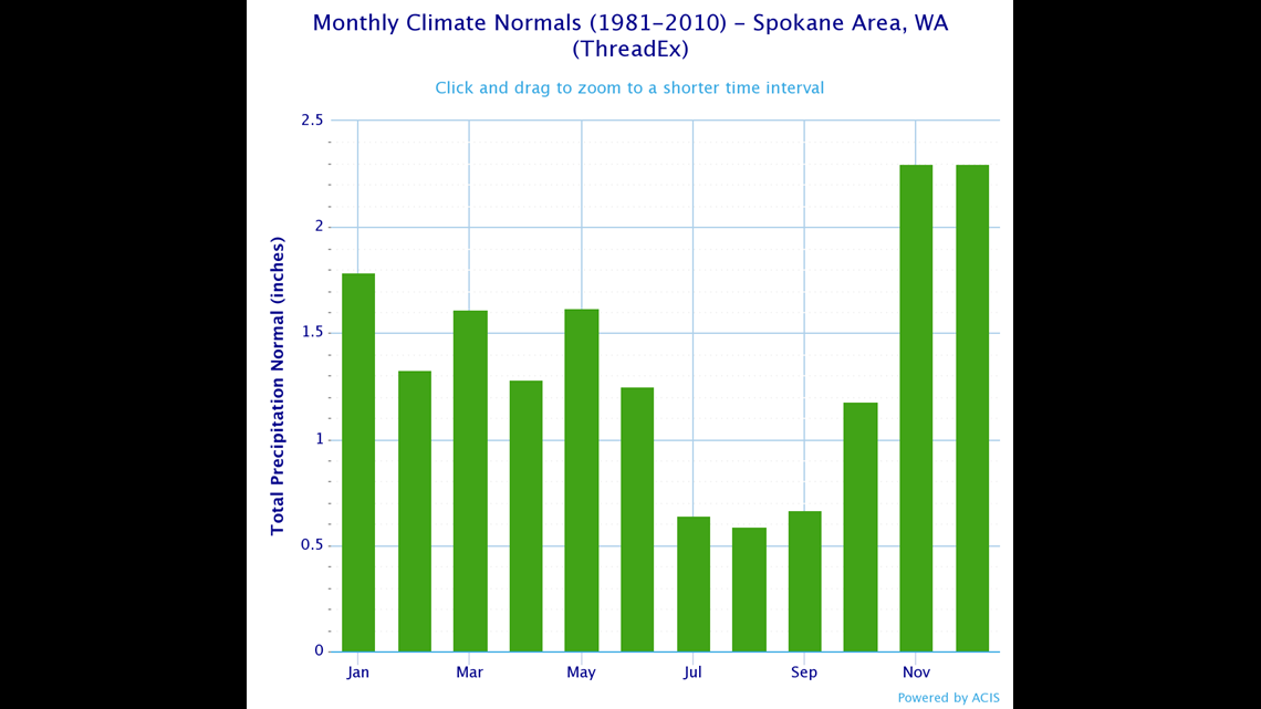
It is still early in the year and there is plenty of time for the state to catch up on moisture. The dry season doesn’t really arrive until July. The month of may typically offers a decent amount of rain for Spokane and the Inland Northwest.


