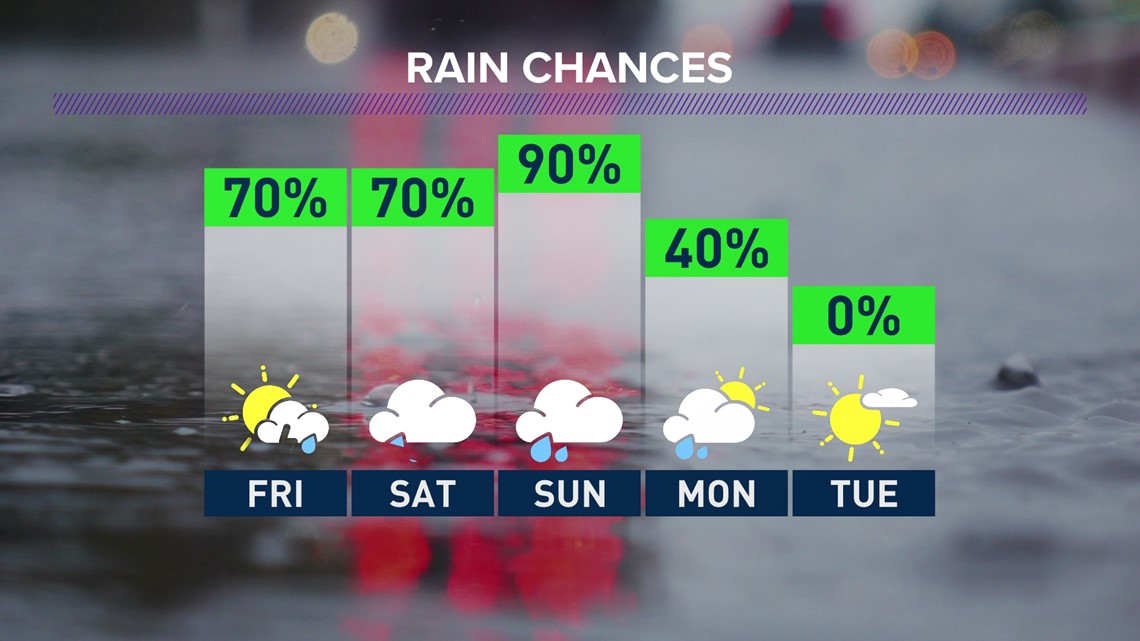
SPOKANE, Wash. — An unsettled weather pattern for the Pacific Northwest will continue to give the Spokane area scattered rain and thunderstorm chances between Thursday, June 2, and Monday, June 6.
The anchored low pressure center over the Gulf of Alaska is, at the moment, fairly stationary and is only guiding some disturbances into Washington for Thursday and Friday before moving into British Columbia over the weekend, providing more widespread rainfall.
Like most spring-like thunderstorms, any shower cells that develop in the afternoon could contain very heavy downpours. Those downpours could be problematic over burn scars from recent wildfires that have charred the ground and soil.
A Flash Flood Watch was issued for the northern Washington mountains until 5 a.m. on Friday, as burn scar flash flooding and debris flows are possible should any extreme downpours hit those scarred areas directly.


Thursday's chances for showers and storms grow greater through the evening. A wave of showers are likely to develop in southeastern Washington around 7 p.m. and move northward towards Spokane and Coeur d'Alene around midnight. The storms will have plenty of thunder and lightning, some small hail, and locally gusty wind but the greatest threat from this initial wave will be the rain.
After the early Friday morning rainfall, another pop-up thunderstorm chance develops Friday afternoon. Again, heavy rain is possible, but "severe weather" is not. Even the Storm Prediction Center does not put the Inland Northwest in the lowest category of severe weather threats.
The weekend is looking wet, but unlikely we'll see storms. The aforementioned low pressure area moves into the Pacific Northwest and will cause temperatures to be cooler and rain to be more likely, but thunderstorms to be less likely.

