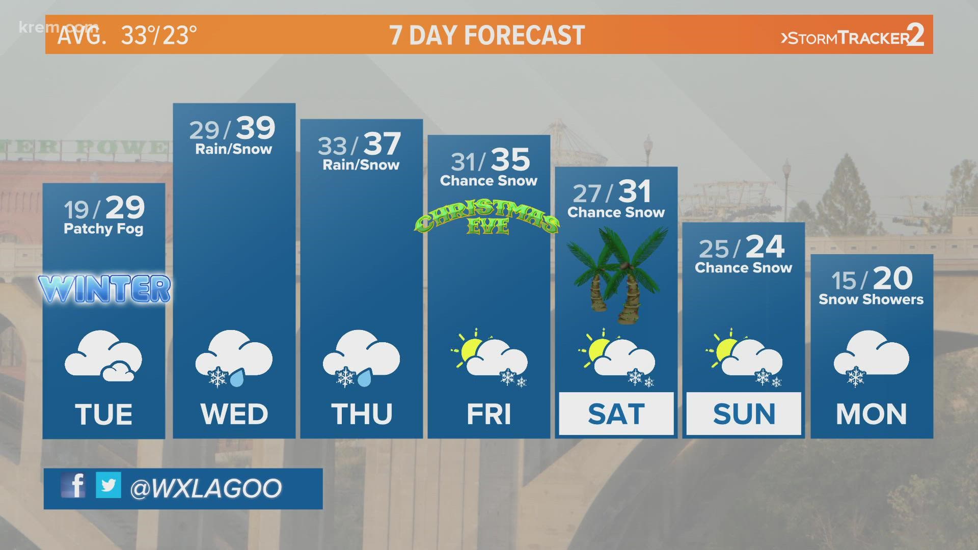
SPOKANE, Wash. — After winter weather led to crashes and slide-offs in the Spokane area on Monday, snow will return Tuesday night for the start of winter.
Several crashes slowed traffic on Interstate 90 in the Spokane area for the Monday morning commute. The City of Spokane said morning snow crews were called in early to pretreat major roads and hills before snow began to fall. WSDOT also reported multiple slide-offs and crashes on westbound I-90 about five miles east of Ritzville.
The next storm arrives Tuesday in the Cascades then Tuesday night in the Inland Northwest, and it looks to be the biggest weather maker of the week. A southwesterly push of moisture coincides with the arrival of our next storm. Cold air in place means the storm will play out very similar to what we saw on Saturday. Precipitation will start as snow before transitioning into rain as a warmer airmass moves in. A few inches of snow are possible before the warmer air arrives. But warming temperatures and rain means a bulk of what is on the ground will melt by the afternoon.
In the mountains, warmer air will likely bring a rain/snow mix to the Cascades. That means slush, snow and ice are possible up and over the mountain passes. For the Northern Rockies, the incoming storm is all snow. In fact, snow is in the forecast every day this week. Inches of accumulation are expected each day. That means it is imperative you check the forecast and have the proper preparations, including chains, if you plan on heading up and over the pass at any point in time this week.
The active weather pattern continues through the weekend. An upper-atmospheric trough in place over the Northwest keeps rain and snow in the forecast. The trough is pronounced enough that temperatures will hover near or below freezing in Spokane and Coeur d’Alene starting Thursday evening. While that is great news for the chance of a white Christmas, it likely doesn’t bode well for road conditions leading into Christmas day.
These storms aren’t anything we haven’t seen in the Northwest before, but keep in mind this time of year is home to more people on roads and a greater potential for traffic and road closures. Drivers should always be prepared for any road conditions when traveling this time of year and make sure to check the mountain pass forecast, as things can be drastically different in the mountains than they are in lower elevations.

