SPOKANE, Wash. — The Inland Northwest is expecting its first fall storm as widespread rain pushes through both Saturday and Sunday. The wet weather will official mark the change of the season as this is rainfall that we don't usually see during the summer time.
The low pressure area anchoring the storm system is moving through the North Pacific on Friday and heading directly towards Washington. The Jet Stream has formed a long-wave trough, and the combinations of these meteorological factors will result in widespread rainfall for the Pacific Northwest in the coming days.
It's already started to rain lightly in central and eastern Washington as the first push of rain and cloud cover has made it to the state. A cold front will mark the beginning for for-sure heavier rainfall during the morning hours Saturday for the Inland Northwest, centered around 8 a.m. in Spokane. After that wave, it'll be mostly scattered showers for eastern Washington and North Idaho for the rest of the weekend.
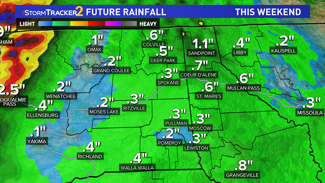
While this means it won't rain all 48 hours over the weekend, the on-and-off rain that does fall will overall amount to about 0.3" to 0.5" in Spokane with about 1" possible over parts of North Idaho.


Okanogan County is under a Flash Flood Watch for this event. This is for the potential of burn scar flooding on high elevation slopes. Extreme drought stricken areas in addition to areas that have recently burned means that the ground and soil cannot absorb any water. So runoff, flooding, and debris flow would quickly follow any sudden burst of heavy rainfall on these areas. But this largely will not affect the cities directly.
While the rain will be inconvenient for outdoor plans, such as the WSU football home game Saturday, the rain will overall be beneficial for the region. The cooler and wet conditions should significantly help fire fighting efforts. Furthermore, the drought situation could improve again. After last Friday's rainfall, Washington saw it's first improvement in the drought since February!

