SPOKANE, Wash. — As the cliche goes... what a difference a year makes.
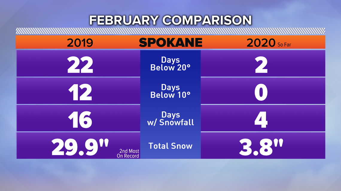
February 2019 was extremely memorable. Nearly 30" of snow in Spokane and several cold day summed up the month. And heading into this February many of us were wondering if we could have a repeat performance.
Nope.
February 2020 has been nearly the complete opposite. Far fewer cold days, and more than two feet less snowfall. In fact, Spokane hasn't even picked up four inches of snow on the month. That, one year after the second snowiest February ever in 2019, when we had 29.9 inches.


The temperatures haven't been bad all this winter either. Only 10 days have been below 20 degrees so far, and zero days below 10 degrees! Snow depth can play a big part in prolonged cold snaps. With fresh snow on the ground, we get what's known as the "refrigeration effect", which directly cools down the atmosphere. This was prevalent last February and March. February 2019 was the 4th coldest on the record, and March 2019 was the 9th coldest.
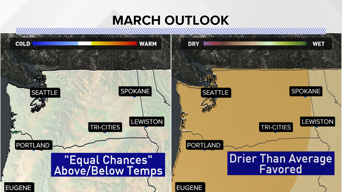
Thus, without the deep snow-pack heading into March, it is extremely unlikely we'll see a repeat of the cold March. The Climate Prediction Center's outlook gives Washington "Equal Chances" for above, below, or near normal temperatures for the month.


One more note, despite the lack of snow in Spokane this February, we're not hurting for snow in the mountains. In fact, all mountain ranges in Washington and North Idaho are reporting near or above snow-water equivalent snow-pack this February.

