
SPOKANE, Wash. — Spokane has already seen 32 inches of snow on the season, more than double the normal pace. And as we approach Christmas this Sunday, one more batch of snow is in the forecast.
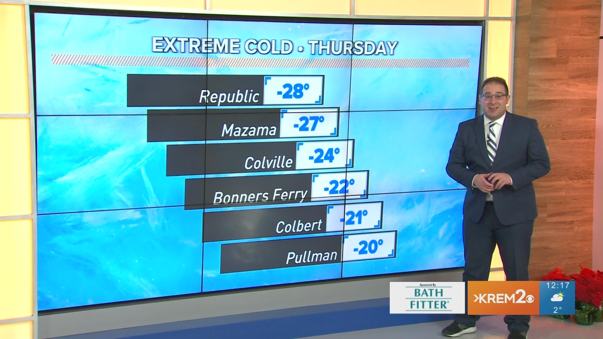
For Spokane and the Inland Northwest, this snowstorm will mark the end of the extreme cold as temperatures rebound to near normal for the Christmas weekend.
Winter Weather Advisory
NWS Spokane has issued Winter Weather Advisories for Spokane, Coeur d'Alene, Pullman, and Lewiston from 4am to 10pm Friday. About another 2-4" of snow is likely to fall through the day with some regions that could close in on 5" at the most.
A quick synopsis of the timeline
Snow flakes could start falling by midnight at the earliest. But the accumulating snowfall will begin in earnest around 4 to 7am. The heaviest snowfall will be during the morning and midday hours with on-and-off snow showers for the remainder of the day. Most of the snow should be down by 10pm or midnight.
Additionally, a second batch of precipitation will hit Saturday, mainly as a rain/snow/slushy mix for Spokane, more snow for northern Washington, and freezing rain for central Washington and the eastern Cascade slopes. This will likely result in more Winter Storm Warnings or Winter Weather Advisories to be issued due to the ice and impacts to road conditions.
Travel concerns
The snow and slick conditions could be quite a problem for travelers, especially those passing through the Cascades. Heavy snow and/or freezing rain is likely for Snoqualmie Pass and other Cascade Passes on Friday. Saturday appears to be a rainy event west of the Cascades, but likely freezing rain east of the Cascades.
It's worth noting that I-84 won't be a safe alternative. Freezing rain is expected both Friday and Saturday for that corridor. Seattle and Portland will get the freezing rain mixture on Friday before switching to rain Saturday.
Freezing temperatures & White Christmas
Temperatures begin to recover from the single digits on Wednesday and Thursday to 20 degrees on Friday, near 30 on Saturday, and the upper-30s on Christmas Day!
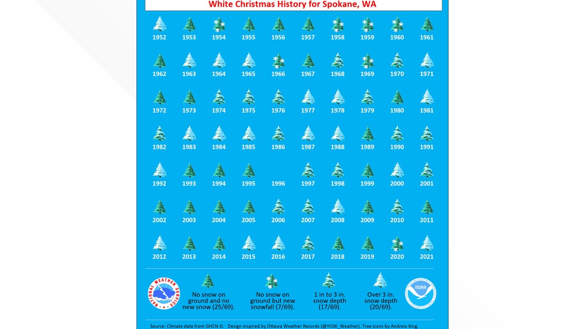
A White Christmas is looking guaranteed for nearly everyone in the Inland Northwest. A White Christmas is defined as having an inch of snow on the ground Christmas morning or snowfall at any point in the day. Spokane historically gets a White Christmas about 50 to 60 percent of the time. But with 14 inches of snow currently on the ground and more on the way... we're guaranteed to have a White Christmas.

DOWNLOAD THE KREM SMARTPHONE APP
DOWNLOAD FOR IPHONE HERE | DOWNLOAD FOR ANDROID HERE
HOW TO ADD THE KREM+ APP TO YOUR STREAMING DEVICE
ROKU: add the channel from the ROKU store or by searching for KREM in the Channel Store.
Fire TV: search for "KREM" to find the free app to add to your account. Another option for Fire TV is to have the app delivered directly to your Fire TV through Amazon.
To report a typo or grammatical error, please email webspokane@krem.com.