
SPOKANE, Wash. — Needed rain returned to the Inland Northwest this week. The rain we saw on Wednesday and Thursday marked a shift in our weather pattern that keeps needed moisture in the forecast in the days to come.
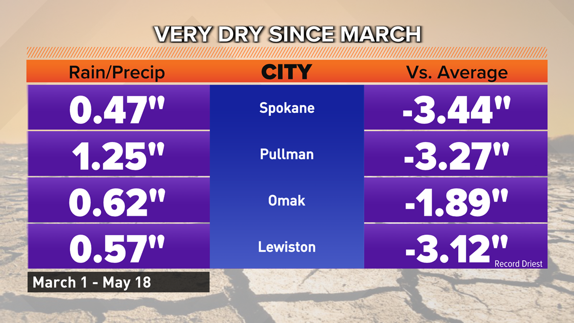
Though a bulk of the showers will be scattered and isolated, we will take any amount of moisture we can get. The first 10 weeks of meteorological spring were exceptionally dry. In that time, many locations recorded an extreme rainfall deficit. Spokane was close to three-and-a-half inches behind normal rainfall in that time before the change in the weather pattern arrived.

Thursday offered the best chance of widespread precipitation for the Inland Northwest. From morning snow in elevations above 4,000 feet to heavy rain in portions of the plains, just about every part of the region recorded some sort of precipitation. Oddly enough, Spokane wound up being on the lower end of the spectrum of recorded rainwater or equivalent.
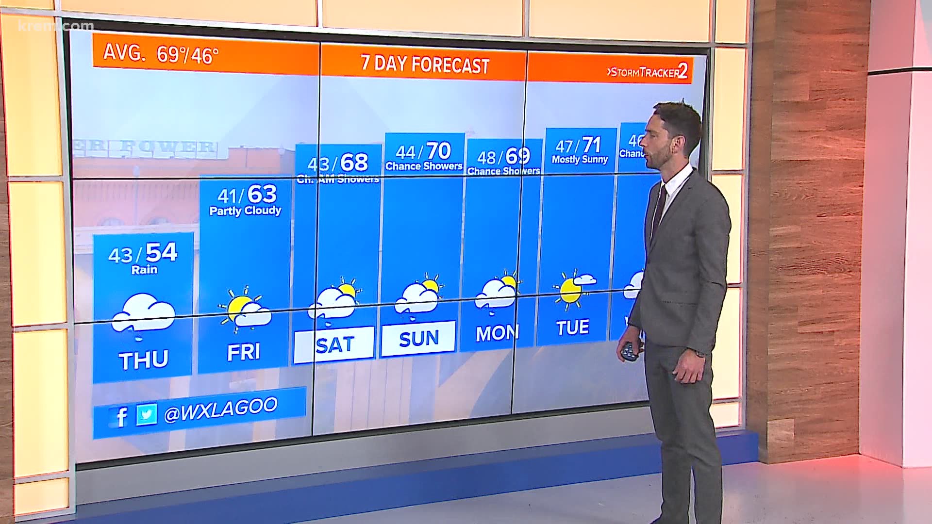
The upper-atmospheric trough and surface low responsible for the rain don’t move much in the coming days. That means the chance of light showers sticks around in the days to come. Shortwaves circling the low-pressure center will offer rounds of precipitation in waves in the coming days. It looks like there will be a break in the action on Friday before the chance of rain returns for the weekend and into early next week.


Scattered showers Saturday, Sunday and Monday don’t offer any drastic storm totals, but days of scattered showers will add up to a dent in our deficit. With Thursday’s rain included, Spokane could pick up almost 1/3rd of an inch of rain by the time the storm moves out. Parts of North Idaho could see even more.
When it comes to the ongoing drought, this rain isn’t likely to have much of an impact. With a deficit like what much of the state currently faces the only way we can turn things around is consistent moisture in the forecast. The most likely outcome is that drought conditions don’t worsen in the updated drought monitor but instead just stay the same.

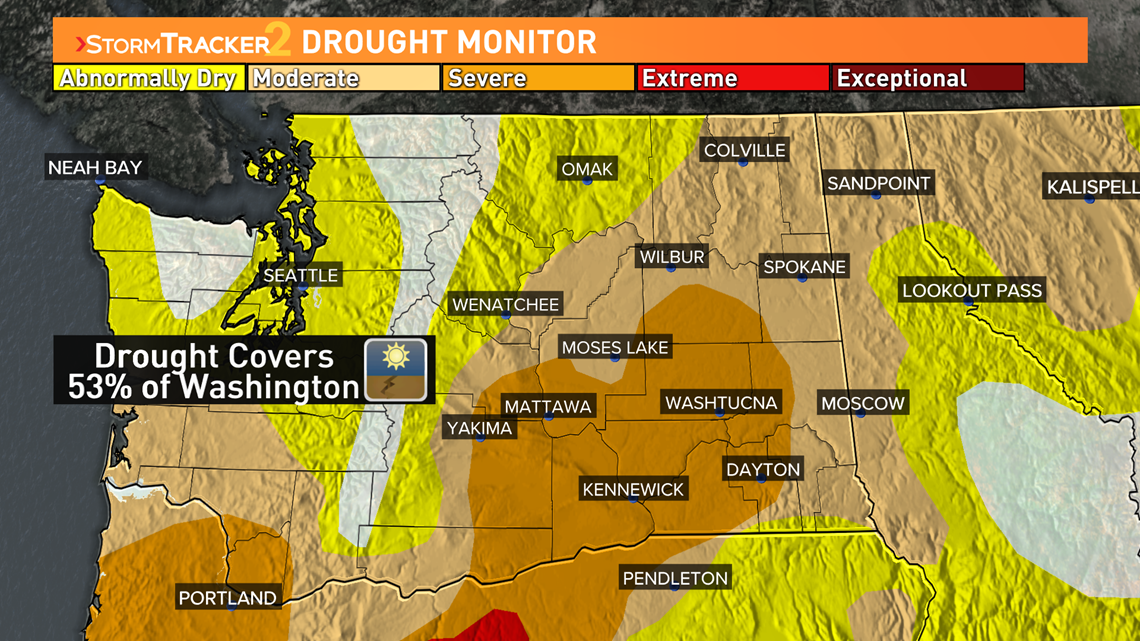
A weather pattern like the one that brought us the rain would have to stick around for a couple weeks in order to give us a jump on the moisture before the dry season starts in the middle of June. Long-range forecast models don’t indicate that will be the case in the weeks to come.