
SPOKANE, Wash. — Another seasonal cold front will pass straight through the Inland Northwest. This time it hits during the middle of the day on Sunday. While we're expecting another round of rain, the wind gusts are forecast to be slightly stronger this time.
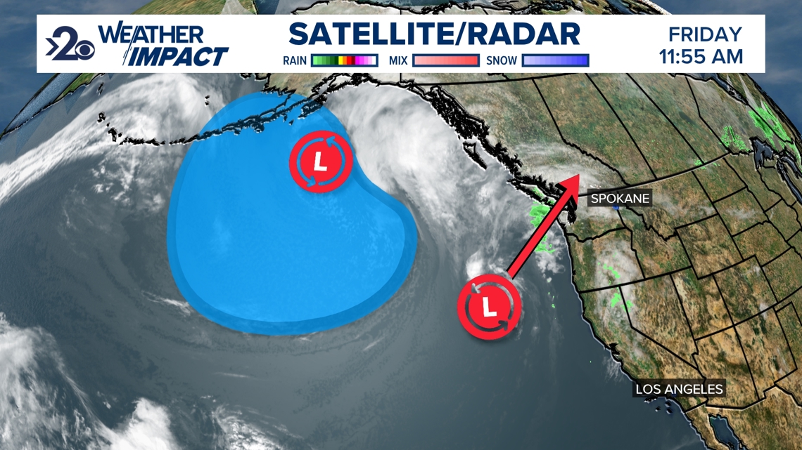
The setup is two low-pressure regions over the Pacific Ocean that will assist one another in terms of the weather impact it'll have on the region. The smaller core that originated out of the tropical Pacific waters is what will carry the frontal boundaries responsible for when the rain chances are most likely. Meanwhile, a much larger low pressure over the North Pacific will push the cold air forward into the Northwest, which the first area will use as energy and momentum forward.
A map might be simpler to describe what's going on, which you can see below:

All this to say, Sunday is a Weather Impact Alert Day for fairly strong winds. The storm will also bring widespread rain, colder temperatures, and impact outdoor weekend plans in general.
In terms of rain, there's a small chance of rain early Saturday morning with the warm front passage. But the rest of Saturday is dry. The earliest Sunday rain could arrive is midnight, but is more likely to start between 6 a.m. to 12 p.m. and last into the early afternoon hours, 12 p.m. to 3 p.m. As for the winds, wind gusts around 25-40 mph will be felt generally between 6 a.m. and 6 p.m. Sunday, likely at their strongest when the rain is falling or just afterwards.
When: 6 a.m. to 6 p.m. Sunday
Impact: Wind gusts up to 40mph, some widespread rain.
Need to Know: Clean up any loose objects in your yard and plan activities indoors for comfort.