SPOKANE COUNTY, Wash. — This summer season has already brought Spokane twenty-one days of 90°+ weather. Four of those days were over 100° and the hottest temperature recorded at the Spokane Airport so far has been 102° which occurred on both July 29th and July 31st. On average Spokane sees nineteen days of 90°+ temperatures per year.
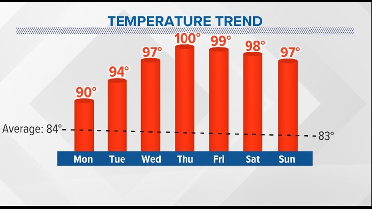
This week's weather pattern has the four corners high pressure system building back into the Pacific Northwest, which will allow our temperatures to soar once again into the upper 90s and low 100s. This could be another prolonged heat wave with the very hot temperatures sticking around through the upcoming weekend. It's possible that monsoonal moisture could work it's way back into the region by the end of the week, however, bringing clouds and potential thunderstorms, which could limit our warming a bit, but it will certainly still be hot.
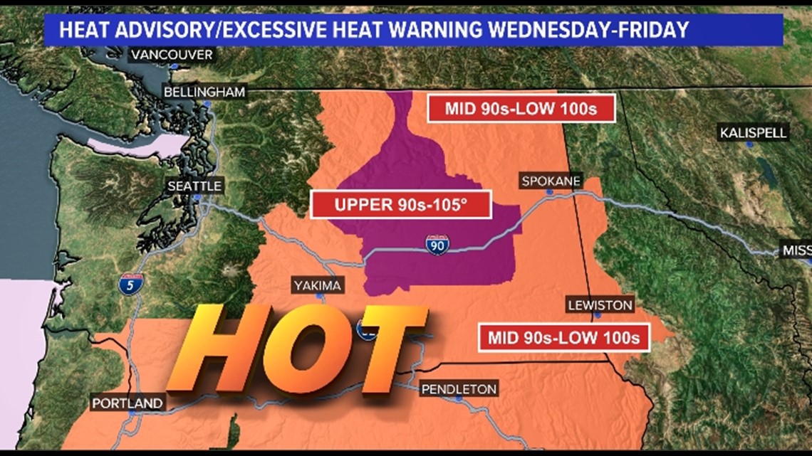
An Excessive Heat Warning has been issued for parts of Central Washington for this Wednesday through Friday with expected highs in the upper 90s to 105° range. A Heat Advisory covers most of the rest of Eastern Washington and parts of the Idaho Panhandle including Coeur d'Alene and Lewiston. These areas will likely see temperatures in the mid 90s to low 100s.


One difference between this forecast heat wave and the one from two weeks ago is the number of daylight hours. We'll have about 50 minutes less daylight this week, than what we had back in late July. More "night" means more time to cool down.
Record highs for the Spokane Airport for the Thursday through Saturday time period range from 100°-101°, so we could be close to tying those records each day.


