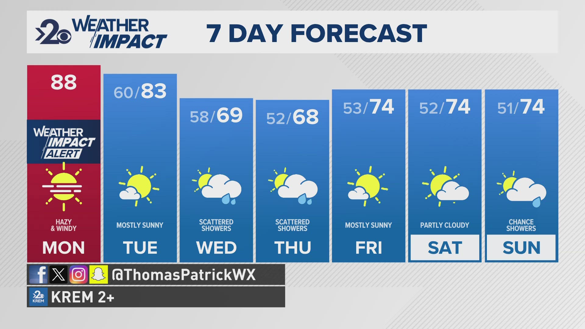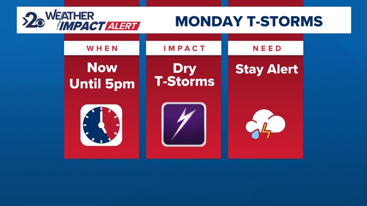
SPOKANE, Wash. — Morning thunderstorms have been pulsating over eastern Washington since 5 a.m. Clusters of storms continue to develop throughout eastern Washington this morning, some containing heavy downpours, small hail, gusty winds, and a few lightning strikes. And the more rain the better as the lightning threat will increase fire danger today. Because of that, Red Flag Warnings have been issued for that dry lightning risk.
The key threat is that the lightning may occur outside of where rain falls since some of these thunderstorms are very small. And, of course, lightning can spark wildfires.
The thunderstorm chance will continue through 5 p.m. Monday. This will be a tricky forecast to nail down since the randomness of the storms themselves will bubble up and come and go as they please. Some of the storm cells will go through an entire life cycle in as little as 20 minutes. So the best we can do as forecasters is track the storms hour-by-hour with doppler radar and watching sky conditions as they develop.
The KREM 2 Weather Team has called for a Weather Impact Alert Day for the Lightning and heightened fire risk today due to thunderstorms.
When: Through 5 p.m. Monday
Impact: Thunderstorms
Need to know: Stay alert for quickly changing weather conditions.