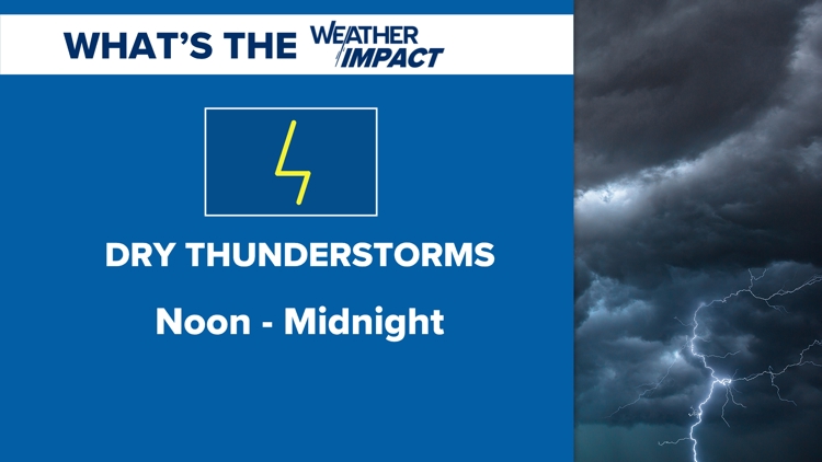
SPOKANE, Wash. — The first thunderstorm chance of the month will result in high fire danger due to the risk of dry lightning.
Red Flag Warnings have been issued for central and eastern Washington until midnight tonight due to the risk of dry lightning. These are thunderstorms that do not contain much rainfall. This creates an imbalance as lightning can spark new fires due to the absence of rainfall.
The chance for thunderstorms will be greatest between noon and midnight on Wednesday, locationwise, over northern Washington. The chance for thunderstorms is a bit lower near Spokane and for eastern Washington, however, it's not zero percent. KREM 2 Meteorologists will be tracking the storms as they pop up and where they're moving on an hour-by-hour basis via Doppler Radar.
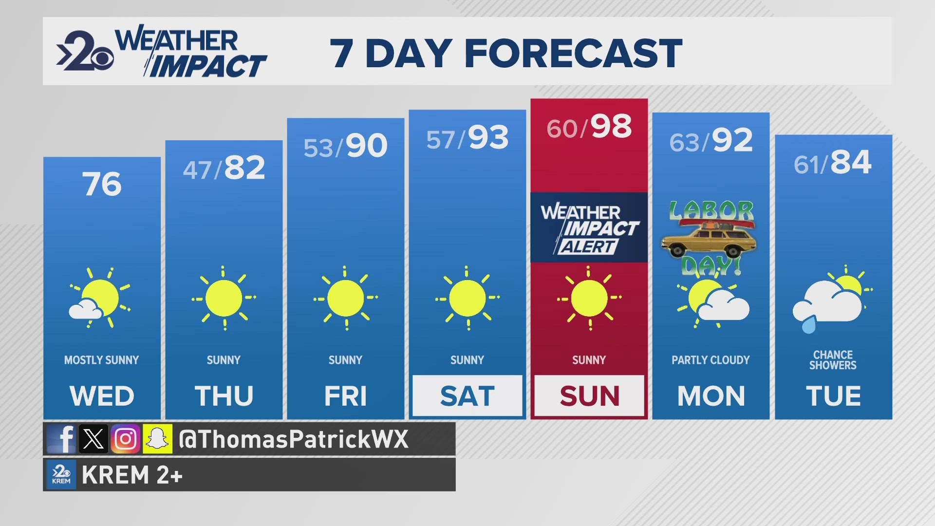
The KREM 2 Weather Impact Alert Days are in place from today through Monday, primarily for the heat wave, but today also for the thunderstorms and high fire danger.
When: July 17 from noon to Midnight
Impact: Dry Lightning & Thunderstorms, High Fire Danger
Need to Know: Lightning strikes can spark and start wildfires in the absence of rainfall