
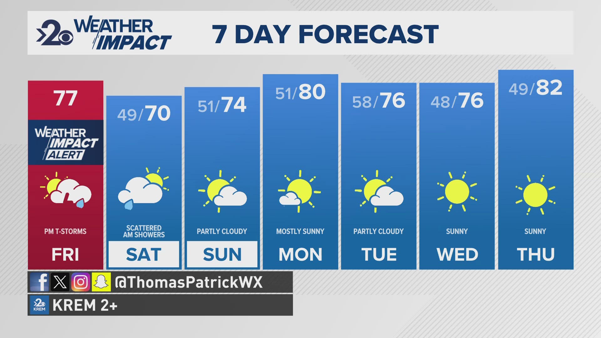
SPOKANE, Wash. — A pretty big swing in temperatures from near 90 to highs in the 60s will be marked by a decent chance for thunderstorms Friday night. The quick change from summer to fall weather has led us to call for a KREM 2 Weather Impact Alert Day on Friday for that thunderstorm chance.
To be clear - these won't be "severe" thunderstorms, but what thunderstorms do occur will be heavy rain producers and can have some gusty winds for those who find themselves directly underneath these storm cells. The storms will most likely be between 4 pm and 9 pm Friday and could occur anywhere across the Inland Northwest. That being said, they will be scattered, not widespread.
Rain totals are expected to be about 1/10th of an inch, or up to 1/4" in total, which isn't much, but that would fall in a matter of just a few minutes. Wind gusts up to 40mph are possible as a result of the thunderstorms.
Furthermore, the Saturday after will be much cooler with highs in the upper 60s. This will be the coldest day in Spokane since mid-June, the last time we were in the 60s for highs. Between then and now, July was the hottest July on record, so we haven't been anywhere close to this cool recently. In a few words: Feeling like fall!
When: 4-9 pm Friday
Impact: Scattered Thunderstorms
Need to Know: Heavy rain and gusty winds possible with thunderstorms before big cool down for the following days.