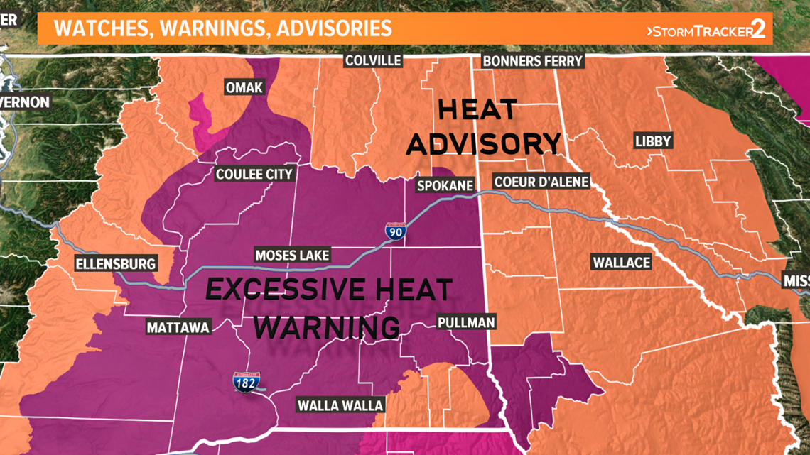
SPOKANE COUNTY, Wash. — A heat wave is in full swing across the western the United States, including across Spokane and the Inland Northwest where high temperatures will reach into the triple digits in many cases.
On Sunday, Spokane hit 101 degree setting a new daily high temperature record, breaking the old record of 100 degrees back in 1967. Deer Park (101° ), Pullman (100° ), and Lewiston (108° ) all hit new record high temps.
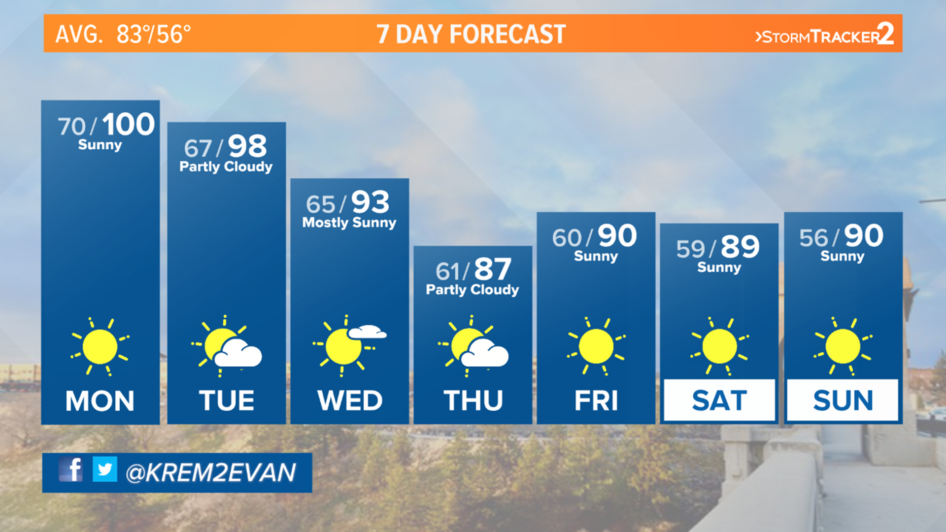
Monday hit 100 in Spokane, which is the second day in a row and third time this year, with more widespread 100s in Washington and Lewiston as well, but probably just shy is records by about three or four degrees. Tuesday will likely be the same story with upper 90s and 100s forecast for the region, but just shy of record highs.
Spokane's record high on Monday is 103 degrees and Tuesday it's 101 degrees.
In anticipation for the dangerously hot conditions, the National Weather Service has issued an Excessive Heat Warning and Heat Advisory for all of the Inland Northwest. This kicked in Sunday and lasts until Tuesday.


While Spokane has seen very little rainfall for July and August so far, there are some rain and thunderstorm chances that come into play this week for the area.
Thunderstorms in western Oregon Monday are moving northeast towards southeastern Washington and central Idaho. Locations close to Lewiston and Grangeville has a 20-30% chance to see a shower or thunderstorm through about 10pm tonight. However, these thunderstorm may contain more lighting than rain and have wind gusts between 40-60 mph in the strongest of cases.
Tuesday night also has another chance for rain and thunderstorms for the Inland Northwest, up through the I-90 corridor, including Spokane. There may be a strong thunderstorm chance as well, but our meteorologist will monitor model and radar trends to determine would might have the best chance to see precipitation.


