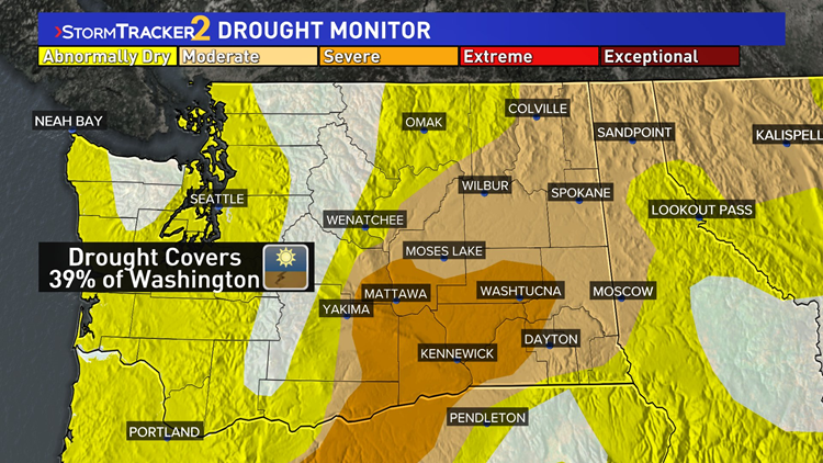
SPOKANE, Wash. — Spring across the Inland Northwest has been unusually dry. So much so that most central and eastern Washington locations are now experiencing drought conditions.
While November and December are Spokane's wettest months of the year, the spring months typically offer about 1.5 inches of precipitation on average. But this year hasn't been anywhere close to those averages. And not just Spokane, but nearly everywhere across the Inland Northwest.
In Spokane, March only saw 0.26" of rainfall (and a trace of snow on a few days). That was the 2nd driest March on record. Then April's 0.21" of rain was the 9th driest on record. Combined, only 0.47" of total precipitation is the 2nd driest on record for the two months together. Only 1924 was drier.
Meanwhile in Pullman, 1.24" is nearly five times as much precipitation as Spokane through the months of March and April. But still was the 4th driest stretch of record as is more than two inches below average.
This trend is the case across nearly all of Washington. And over the past couple of weeks, the U.S. Drought Monitor has shown the drought conditions has spread across nearly all of central and eastern Washington heading into May.
Even western Washington and the Seattle area are running abnormally dry, which is a stage before drought.
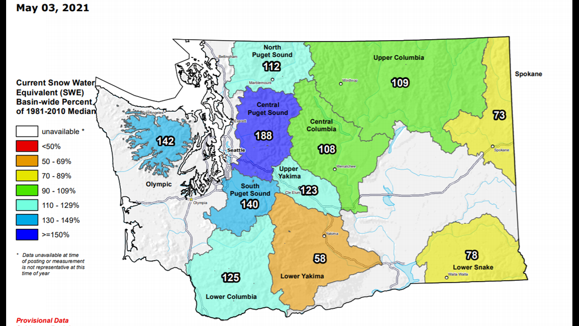
The only area of Washington not running dry is the Cascades. A large snowpack over the winter has mitigated the risk of drought conditions developing this early in the year. The western Cascades snowpack is still above average, as much as 187%.


There's still time to get a decent rainfall for Spokane and the area. May and June still average more than one inch of rain in Spokane. But by July that drops off as the summer is the dry season for the area. And it won't do our area any favors going into the summer with a rain deficit from spring.


