SPOKANE, Wash. — A record amount of snow through March in the Inland Northwest may have many residents concerned about flooding as the aftermath melts away.
February of 2019 brought the second heaviest snowfall on record and the heaviest snowfall in over a century. Due to abnormally cold temperatures trending about 10 to 15 degrees below average, much of the snow did not melt.
Spokane saw a record 15 inches of snow on the ground as of March 12.
Despite a record amount of snow on the ground in early March, mild and dry weather later in the month helped gradually melt snow in the valleys around the Inland Northwest.
According to National Weather Service meteorologist Greg Koch, there are no concerns for river flooding due to below-average mountain snowpack totals in the Inland Northwest. Koch said the traditional melt-off period is April and May.
This doesn't mean Inland Northwest residents are out of the woods yet, though. A prolonged period of warm, wet weather could lead to river flooding. At this point, signs are not pointing to flooding that may come soon.
It’s a different story entirely in eastern Oregon, and parts of north-central Idaho and southern Idaho, Koch said. Mountain snowpack numbers were higher in those areas.
Koch said there is some flooding on the Rhonde River in southeast Washington but it is very localized right now.
In Oregon, flood warnings remained in effect on Monday morning for southern Oregon, the mid-Willamette Valley and the northern Oregon Cascades. Some rivers in the area are rising above the flood stage and prompting evacuations.
In our area, the Coeur d’Alene and St. Joe rivers are rising but they are not likely to go over flood stage, Koch said.
The water remains cold despite warming temperatures, so residents should be careful about going into the water.
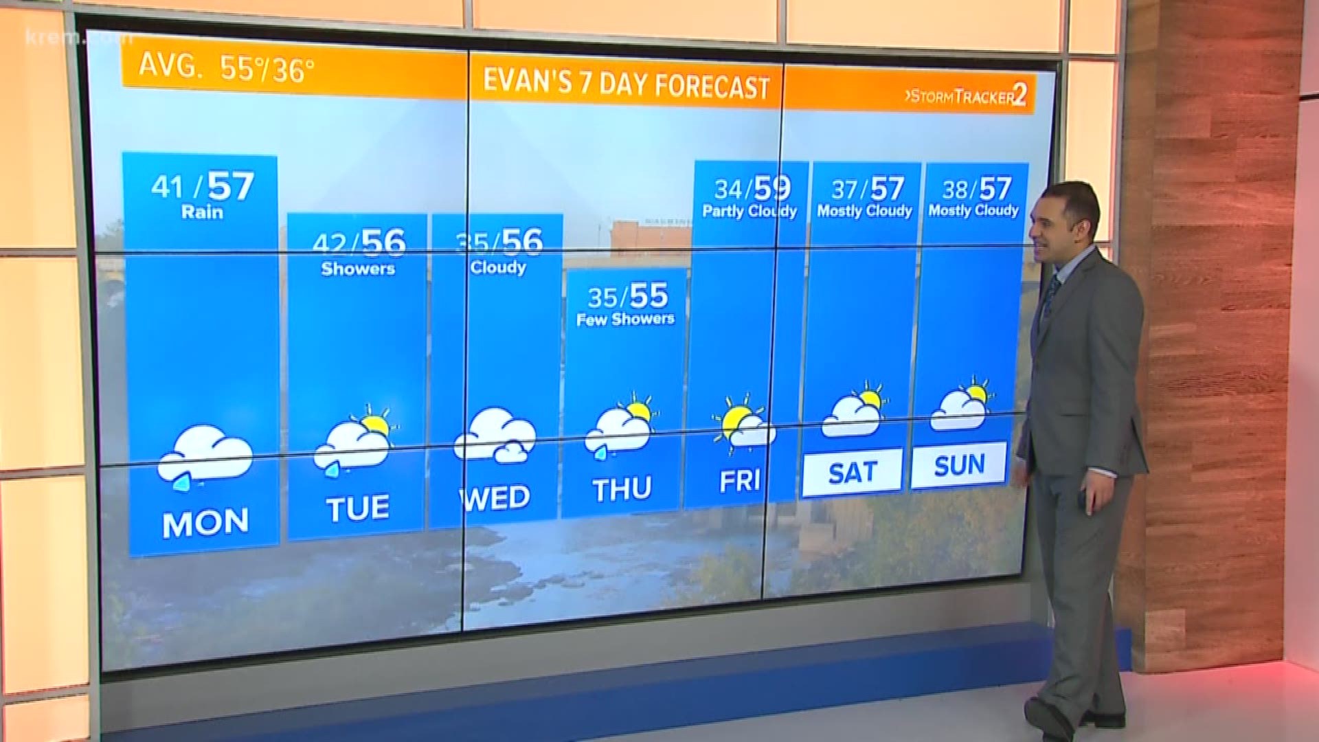
Wet weather continues in Spokane this week, with scattered rain showers through Thursday. The best chance for a dry day is Friday, according to the National Weather Service.


