
BOISE, Idaho — Wildfires have been burning throughout Idaho. KTVB updates this article daily with new information on acreage, containment and evacuations.
Fire Listings:
Goat Fire (Oct. 31)
The Goat Fire has burned over 35,648 acres and is 51% contained. Evacuations for Silver Creek and Boiling Springs have been lifted.
BNF announced on Thursday, Oct. 31, that they are lifting all road, trail, and area closures associated with the fire.
Snag Fire (Oct. 31)
The Snag Fire had burned 33,437 acres and is 90% contained.
BNF lifted all road, rail and area closures.
People who need more information can sign up for notifications at CodeRED: https://public.coderedweb.com/CNE/en-US/BFCA66524AE5
Middle Fork Complex: (Oct. 31)
The Middle Fork Complex Fire was once three separate fires that pushed together into one fire. It is burning nine miles east of Garden Valley. The fire has collectively burned 61,495 acres and is 95% contained.
BNF lifted all road, rail and area closures.
Lava Fire (Oct. 31)
The Boulder Fire has incorporated into the Lava Fire and is now just called the Lava Fire.
The Boise National Forest on Thursday, Oct. 31, announced the general forest area of the Lava Fire in their boundaries is opening after being closed for safety.
"However, some roads and trails will remain closed for the foreseeable future for public safety and natural resource protection due to damaged bridges, and other infrastructure impacted by the fire and post fire flooding. These areas will continually be reevaluated to see which risks can be mitigated before public access will be allowed," BNF officials said in a news release.
The Lava Fire is near Ola, Idaho. It has burned roughly 97,585 acres and it is 94% contained. People can learn about closures and evacuations at the Gem County Sheriff's Office and the Valley County Sheriff's Office.
As of Oct. 2, there are updated closures in the area of the Lava Fire. Gem County Road and Bridge issued the following closures: Third Fork Road at Nesbitt Lane, Second Fork Road at Nesbitt Lane, and Nesbitt Lane. The Sweet-Ola Highway is closed at the High Valley intersection in Ola.
As of 8 a.m. on Sept. 20, fire officials announced that all evacuation orders have been lifted for Gem County.
The Boise and Payette National Forests have reduced the closure orders effective Sept. 20, opening more areas to the public.
Emmett and Cascade Ranger Districts have also rescinded Stage 1 fire restrictions as of 8 a.m. on Sept. 20.
As of roughly 12:30 p.m. on Sept. 17, Valley County Sheriff's Office downgraded several evacuation orders. Zones 2, 3, 4, 5 and 6 have been downgraded to "READY" status, and Zones 7-11 have been removed from any evacuation status.
Wapiti Fire (Oct. 20)
The fire has burned over 12,9063 acres and is 90% contained.
On Thursday, Oct. 31, BNF said the area adjacent to the Grandjean Summer Home subdivision has lessened.
On Monday, Sept. 16, the Boise County Sheriff's Office announced the following downgrades to evacuation orders:
- We are downgrading all evacuation levels to Level 1.
- The Idaho Transportation Department (ITD) will be meeting in the coming days to discuss reopening Highway 21, which may include potential restrictions.
- Please be aware that some forest roads remain closed, which could affect hunting access. We encourage you to check with the U.S. Forest Service for up-to-date information on any closed backroads.
Red Rock (Oct. 28)
Fire officials released an update on the Red Rock Fire, which has collectively burned an estimated 79,260 acres and is 88% contained.
An Idaho Department of Lands document states that the Red Rock Fire was started by lightning on Sept. 2. Another fire, Black Eagle, merged with the Red Rock Fire on Oct. 5.
Evacuations: Evacuation information in Lemhi County regarding both the Red Rock and Garden.
On Sept. 17, the Salmon-Challis National Forest announced a series of road closures, due to the Black Eagle Fire:
- NFS lands, roads and trails on the Salmon-Cobalt, and North Fork Ranger Districts of the Salmon-Challis National Forest within the area bounded by the following:
- Beginning at the intersection of FS Road 112 and 055 (Panther Creek Rd) to the intersection of FS Road 112 and 113. Then following FS Road 113 to its intersection with trail 029 (FS Roads 112 and 113 are closed to the public). Then following the Frank Church River of No Return Wilderness Boundary to the Golden Trout Lake Trailhead, including the Big Horn Crags Campground and crossing over into the Frank Church River of No Return Wilderness and onto the ridge to the West of Wilson Creek, then going South to Middle Fork Peak. From Middle Fork Peak to the Frank Church River of No Return Wilderness Boundary to trail 053 then running along Little Jacket Creek to Trail 051, then following Trail 051 to Birdseye Creek to Forest Road 245 at its intersection with Panther Creek road 55. Then following the western side of FS Road 55 (Panther Creek), to the intersection of FS Road 55 and 112.
- The purpose of this order is to protect public health and safety during the Black Eagle/Red Rock Fire.
- This Order shall be in effect from September 17, 2024, at 8:00 am until rescinded.
Garden Fire (Oct. 245)
The Garden Fire is roughly two miles southwest of Panther Creek and Main Salmon River, on the North Fork Ranger District in the Frank Church River of No Return Wilderness.
Evacuation updates can be found here.
The Idaho Department of Lands reported the fire burned roughly 13,036 acres, with 25% contained.
Fire officials said the Garden Fire started on Sept. 8 and was caused by lightning.
Closures:
All roads and trails on the Boise Front segment of the Boise River WMA west of Highway 21 and north of Warm Springs Avenue are closed to all entry until further notice. This closure also extends to all travel off roads and trails. Visit https://idfg.idaho.gov/article/portion-boise-river-wmas-boise-front-segment-closed-all-entry-due-valley-fire. There is a Boise National Forest Valley Fire Area, Road and Trail Closure. Visit https://www.fs.usda.gov/alerts/boise/alerts-notices or contact the Mountain Home Ranger District at 208-587-7961. Idaho Department of Parks and Recreation has an interactive map that shows trails impacted by the Valley Fire. Visit https://arcg.is/10maj91.
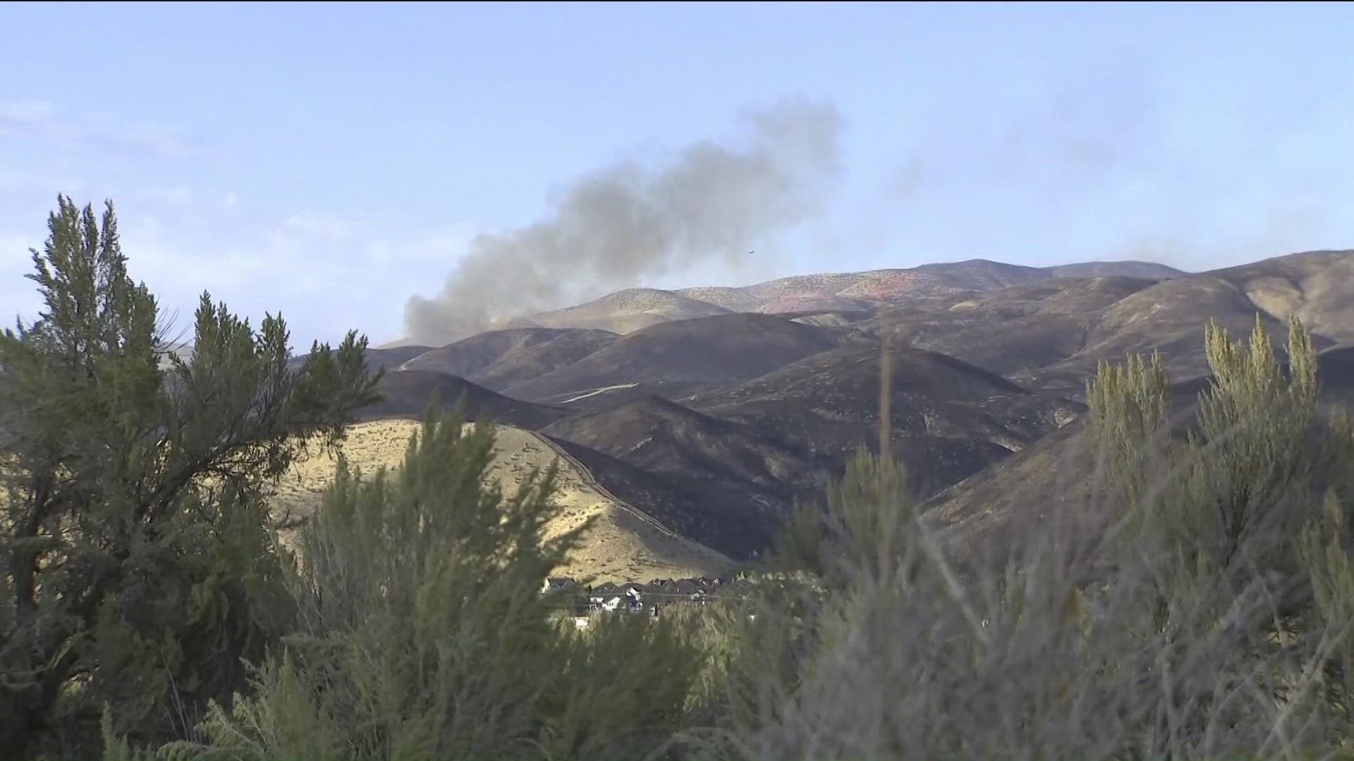
Valley Fire (Oct. 24)
The Valley County Sheriff's Office announced on Thursday, Oct. 24, that evacuations on county roads have been lifted. However, United States Forest Service roads are left unchanged.
"As of Thursday, the U.S. Forest Service - Boise National Forest and U.S. Forest Service - Payette National Forest are rehabbing areas and completing clearing of deadfall for safety in burned areas," the sheriff's office said.
On Monday, Oct. 21, fire officials stated they are releasing the final update on the Valley Fire one mile east of Boise.
Fire officials said the containment line to prevent the fire from reaching homes is complete as of Monday afternoon.
"Heavy equipment operators and firefighters restored 33 miles of dozer and handline, returning it to a more natural state ready for regrowth. Erosion control was built into the repairs and seeding of those lines by fire crews is finished. The seed was carefully selected for the Boise Foothills landscape," fire officials said in a news release.
On Wednesday, Oct. 16, the Boise County Sheriff's Office said the Robie Creek evacuation level had been lifted. The fire has burned 9,904 acres and is roughly 95% contained.
"There are no further areas in Boise County that are under evacuation readiness recommendations," the sheriff's office said in a news release.
For a list of trail closures, click here.
Logan Fire (Oct. 20)
The Logan Fire was mapped at 15,638 acres. It's 10% contained and evacuations for Edwardsburg and Big Creek have been lifted.
Chimney Fire (Oct 20)
The Chimney Fire is burning in the Sawtooth National Forest, near Deer Mountain. It has burned 6,521 acres, and is 80% contained.
There are closures due to the Chimney Fire. A full list of closures can be found at this link.
Vanity Fire (Oct. 20)
The Salmon-Challis National Forest has announced that the Vanity Fire has resulted in some road closures, as the fire has burned 600 acres and is 30% contained.