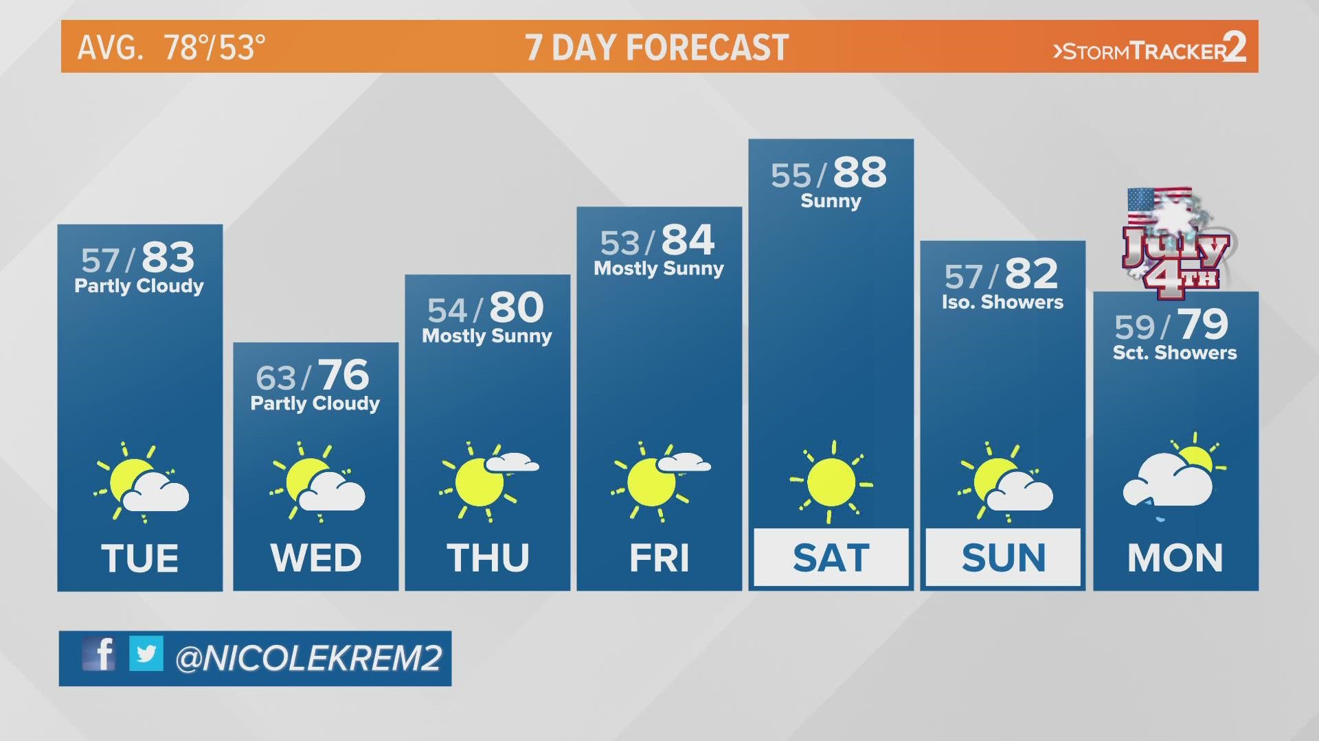
SPOKANE, Wash. — A cold front moving through the region is cooling down temperatures in the Inland Northwest. After seeing the first 90-degree day of the season Monday, high temperatures dipped back down to the mid-80s.
The Stormtracker 2 team is tracking a few isolated thunderstorms and showers ahead of the cold front this morning. Omak saw the bulk of that convection through the morning hours. Those storms will mostly clear out as that cold front moves through.
Wednesday will be the coolest day of the week, with high temperatures in the mid-70s for the Spokane, Coeur d'Alene area.
With an unusual start to the summer, the Inland Northwest started to feel familiar seasonal temperatures. While Western Washington is currently in a heat advisory, the Eastern side of the state is warmer up and peaked up to 91 degrees on Monday.
The National Weather Service advised of moderate heat risk and high heat risk on Monday. This impacts those who are sensitive to heat or lack effective cooling and hydration methods.
While Monday sweltered up into the 90s, Tuesday will bring possible thunderstorms through northern WA and northern ID Panhandle. Effectively cooling down temperatures back into the mid-70s.
-KREM 2's Nicole Hernandez

