SPOKANE, Wash — A heat wave affecting a majority of the central and eastern United States shifted westward over the weekend, signalling a significant warm-up across central and eastern Washington.
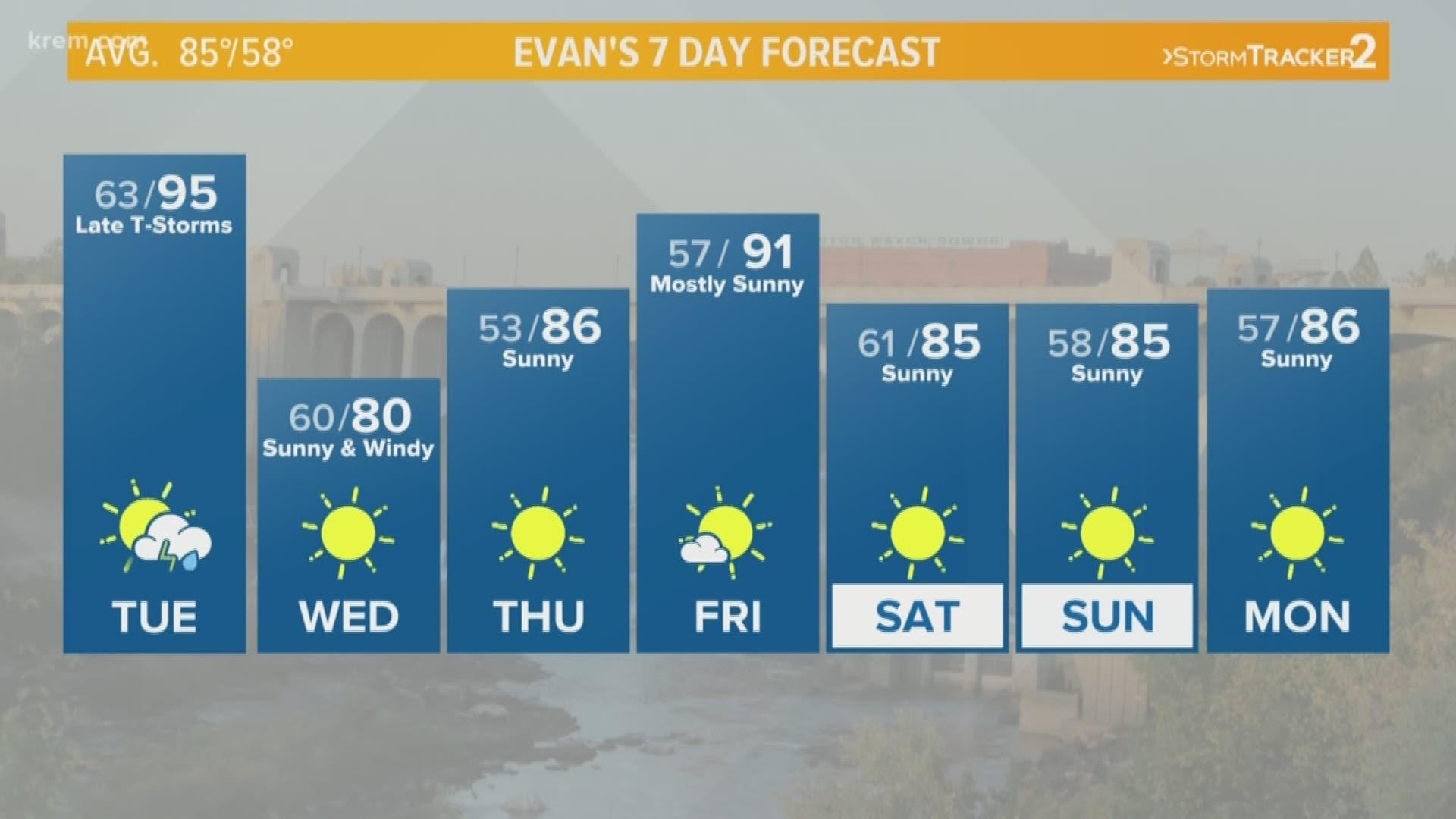
In Spokane and other parts of the Inland Northwest, that means temperatures of 90 and above. While Monday brought record temperatures for this year, those records are expected to be quickly broken once again on Tuesday afternoon.
By Monday afternoon, temperatures hit 92 degrees in Spokane. Much of the Inland Northwest also saw temps in the 90s or upper 80s. Moses Lake saw a sweltering 97 degrees, Colville hit 92 degrees and Pomeroy was 96 degrees.
High temperatures on Monday were running about five to 10 degrees above average, with even hotter temperatures expected on Tuesday.
Tuesday has the potential to be hotter than Monday, with mainly 90s across Washington, Idaho and Montana. Some cities, such as Richland, have a forecast high in the triple digits. The plus side to sweltering heat is an end to cloudy and drizzly conditions as sunny skies move in.
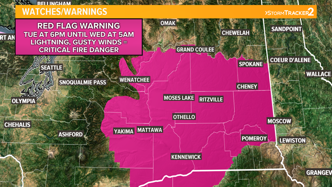
While Tuesday will bring a majority of sunny conditions throughout the day, the evening and overnight hours will include a change. A Red Flag Warning takes effect at 6:00 p.m. as wind gusts pick up and the threat of evening and overnight thunderstorms increases.


Monday was the first time temperatures broke 90 this month, so this heat wave will definitely warrant a big change in current conditions. Do not expect any precipitation over the next week — just sunny skies and maybe a few clouds. This will exacerbate an already bad drought season.
One important note is that heat-related deaths account for more deaths than any other weather-related disaster. It is especially important to ensure access to air-conditioning, water and shade, especially for elderly and young people.
By the middle of next week, temperatures will stabilize to around normal in the mid 80s.


