SPOKANE, Wash. — For the first time in 2019, widespread snow will fall across the Inland Northwest. Many locations will see a snowy Tuesday evening commute before rain makes things more slushy Wednesday morning.

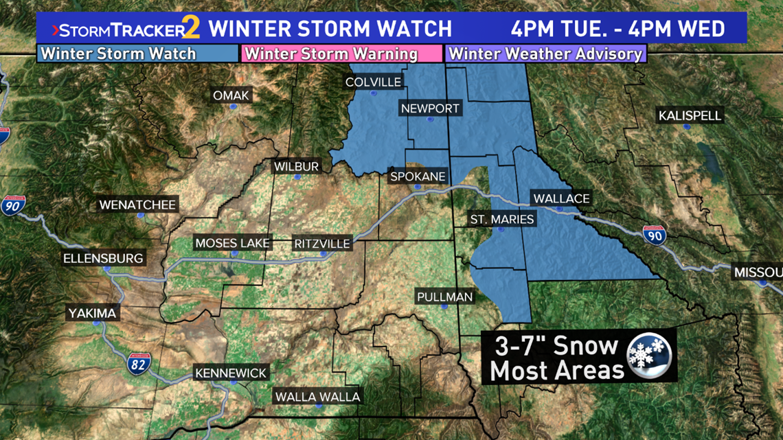
Winter Storm Watches issued for far northeastern Washington and the Panhandle Mountains in Idaho. The time frame is slightly different per region. Here's the breakdown:
Northeast Washington Mountains - 4 p.m. Tuesday to 10 a.m. Wednesday - This includes Colville, Northport, Deer Park, Chewelah, and Newport.
Northern Idaho Panhandle - 6 p.m. Tuesday to 10 a.m. Wednesday - This includes Sandpoint, Bonner Ferry, and Schweitzer Mountain.
Central Idaho Panhandle - 6 p.m. Tuesday to 4 p.m. Wednesday - This includes Kellogg, Wallace,
The snow will start spreading from west to east after about 3 p.m. Tuesday moving into Spokane and Coeur d'Alene during the Tuesday evening commute hours. We'll likely see slower speeds on all the main highways and I-90 during this time. Around midnight, the snow will start changing over to rain. It'll be a lot more slushy by Wednesday morning. The mountain passes to the east, like Lookout Pass and 4th of July Pass, will continue to see snow most of the day Wednesday.

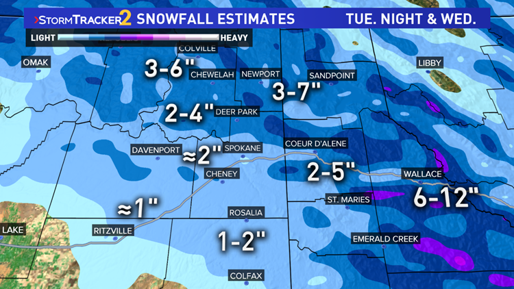
Snowfall totals breakdown like this:
6-14" mountain peaks in Idaho
3-7" valleys in northeast Washington and Idaho
2-5" Deer Park and Coeur d'Alene
About 2" Spokane, Cheney
About 1" or less to the west and south of Spokane.